Year 2 Days 136 and 137 Falls Lake Recreational Area, Wake Forest, NC


Yesterday, we continued our leisurely journey up the southeastern seaboard as we drove another 3.5 hours from our campground in rural South Carolina to our new campground near Wake Forest, North Carolina.  Driving along the rural roads of South Carolina was, at times, a bit of a challenge because the lanes were very narrow, there were no shoulders along the lanes and the trees draped over the road, hanging lower than LeuC’s height.  Thus, to avoid hitting limbs and leaves, we had to drive down the middle of the road.  That worked great as long as we were on a straightaway and no other vehicles were coming toward us.  However, whenever we approached a curve or we could see a car or truck driving toward us, we had to return to our side of the road and slow down to let that vehicle pass us before the next limb arrived to knock our bus.  This went on for about 30 miles, until we reached the entrance ramp of the I-95 freeway.

south-carolina rural roadsThe rest of the drive was easy-peasy even though we had to drive through a couple of areas with construction and the traffic was remarkably heavy for a Tuesday.


We arrived at the Rolling View Campground, which sits on a peninsula that juts out into Falls Lake.  It is one of a number of campgrounds within the Falls Lake Recreational Area that is located between Wake Forest and Durham, North Carolina.  It is another very nice park and we are nestled in a wonderful site, deep in the middle of an oak and pine forest.


Today, we decided to mostly hunker down as a massive front is slowly moving over us, dropping huge amounts of rain.  We were able to sneak out for lunch before the rain hit, using our little Fiat to drive over to Durham where The Pit restaurant is located.  Our son, David Paul, had suggested that we just had to sample some Carolina BBQ before we left the Southeast.  Thus, we bellied up and I ordered some smoked ribs covered in a sweet BBQ sauce.  The ribs were good but a little dry for my taste since they are cooked overnight in a low temperature smoker.  They were smoky good but I prefer my ribs on the moist side.  What was excellent was the Brunswick stew that was served as one of the side dishes.  The last time we had Brunswick stew was over 40 years ago and we had forgotten how tasty it was. The hush puppies and mac and cheese were also excellent.  Mary Margaret had a delicious plate of fried chicken strips that were crunchy on the outside and moist on the inside.  It was all washed down with a local draft brewed red ale.  Yum!


We rolled out of The Pit and barely made it back to LeuC before the rain started.  I was fortunate to have the rain stop for a couple of hours as the sun set which allowed me to start a campfire and enjoy my nightly Cuban and a dram of Scotch while some wonderful classical music played on my cell phone. 20180515_191135


We will be here for 4 nights before moving on to Jamestown, Virginia.  Live is good!


Explorating Charleston Photos


As we sit here in the rain at our new campsite in the Falls Lake Recreational Area, near Wake Forest, North Carolina, I finally have the time and the Internet connectivity to post the photos I took last week of Charleston.  The focus was on the historical district, with its many historical homes, and the county park beach area over on Folly Island.  I hope you enjoy them.


Year 2 Days 132 to 135 Incognito


We left our campground near Charleston last Saturday and drove about three hours to our next site.  This time it was the Little Pee Dee State Park.  We knew that it was a little out-of-the-way park, located in rural part of South Carolina’s piedmont, just south of the North Carolina border.  However, we did not realize how remote it was until we had set up camp.  At that time, we found that we had no reliable Internet, no cell phone coverage, no access to any “local” TV channels, and due to the dense forest that we were located in, no clear line of sight to any TV satellites.  Basically, we were cutting off from communicating with the rest of the world.


For us, it was not much of a big deal, since we had lived for 10 years on our sailboat without TV and during ocean passages did not have great commination options.  When we started out sailing, we could download our emails and weather reports using our SSB (single side-band) radio as a modem that connected to a land-based computer network around the world but it was very s-l-o-w and connecting to the computer network was at the discretion of solar flares and atmospheric interferences.  By the time we finished sailing last year, things had improved with a satellite-based system of communications called Iridium but, compared to what one has on land, it is rather limiting.  With that background, you may have a better understanding as to why we felt like we were, once again, back on our boat in regards to communicating with the world.


We were disappointed that we had no reliable communication options simply because Sunday was Mother’s Day and Mary Margaret could not talk with our three kids as they each tried to reach out to wish her a happy Mother’s Day.  We knew they each reached out because every now and again, we would be able to hookup to the Internet through some spurious signal that flickered one bar of strength on our Internet meter.  Whenever that happened, we checked our emails and messages and sometimes they would download.  I was even able to post a blog post that I had written right before leaving Charleston but had run out of time to post before we left.


Little Pee Dee State Park was a nice enough park with about 50 dirt sites.  Each had a 30 Amp hookup and water, so that was great.  During the days we were there, the afternoon temperatures got into the 90’s therefore, it was wonderful being able to run LeuC’s 3 A/Cs.


The park’s local claim to fame was the little lake that it bordered on, being created by an earthen dam and small concrete spillway.  However, last year Hurricane Mathew dumped so much rain in this area that the lake overflowed the dam and washed a section of it out.  This drained the lake and created a weedy, mucky meadow instead.  Thus, the fishing and swimming that the locals loved, was no longer possible.  Plus, the scenic beauty of a lake on the shores of this park was gone.  Sigh!  On a positive note, the ranger shared with us that the dam will be reconstructed sometime this year and by this time next year, the lake will be restored.

The Dry Spillway And The Break In The Earthen Dam

20180513_132115

Two Little Guys Who Were Fishing In The Remnants Of The Little Lake

20180513_132017

The Mucky Meadow Where The Lake Used To Be

20180513_125854

What View This Would Have Been A Year Ago!

20180513_125239

A Petrified Tree Trunk.  Go Figure! 

20180513_125654

Besides taking walks, playing cards, reading, listening to music and enjoying a late afternoon fire, there really was not much to do.  Thus, we just kicked back and relaxed.  It was nice to rest up a bit after running around the Charleston area, catching as many of the sights we had time for.


As I write this blog, we are now safely set up in the Falling Lake State Recreational Area, near Wake Forest, North Carolina.  We left our Little Pee Dee State Park campground this morning and drove another 3.5 hours north.  We have not yet explored it so I do not have any photos of this park to share.  Instead, I will post a couple of photos of Little Pee Dee State Park.  In a separate blog, I will finally post the photos I took while exploring Charleston’s historic district and our afternoon stroll along the Folly Island County Park beach.


Year 2 Days 130 and 131 More Of Charleston

We are now at Little Pee Dee River State Park, located just south of the North Carolina border and near Dillon, SC.  It is very rural and remote with no cell coverage and very poor and intermittent Internet.  I am posting this blog now because I did not have time to do so before we left our campground near Charleston.  I am not able to attach the photos I took, described mentioned before because the size of the photos are too large for the weak and narrow bandwidth of the Internet we now have.  I will try to post them in a few days when we move to our next campground in North Carolina.  Hopefully, we will have better Internet at that time.

************************************************************************************

Yesterday and today we explored more of Charleston.  Our time here is limited so we wanted to pack as much in as possible.  Charleston is the home of Fort Sumter, the fort where the start of the Civil War broken out back in April, 1861.  It is now part of the National Park system with a little passenger boat running between the museum at Liberty Square in the historical district of Charleston and the Fort out in the bay.  We had made reservations a couple of days ago to take the boat over to the fort and explore it.


South Carolina was the first of 11 states to secede from the Union when they declared independence in December 1860.  At that time, the US was maintaining a small garrison of 85 men at one of the three forts that guarded the opening to the bay and Charleston.  The commander decided to move his small force over to Fort Sumter which was the best protected of the three forts.  At that time, the fort was five stories tall and was designed to be manned by 650 men.   When the forces of South Carolina started its bombardment of the fort, it was lobbing its shells 1 ½ miles.  The shells were heated before firing so they would cause fires to break out upon impact.  After the third fire broke out after two days of bombardment, the commander decided to surrender because he did not have enough men to control the fires and still maintain any of his cannons.  The terms of the surrender were such that the garrison would be released and allowed to return to the north, while South Carolina would take control of the fort and their bay.  No lives were lost during this first conflict of the Civil War.  I will post a number of the photos I took below.

FORT SUMTER BEFORE THE BOMBARDMENT20180510_130827-001

FORT SUMTER AFTER THE BOMBARDMENT

20180510_131207-001


Our two-day exploration of Charleston included walking around the historic district to see the various historic houses that are so unique to this town.  The weather was perfect and I will let the pictures I took show what we saw.


This afternoon we decided we just needed one more ocean “fix” so we returned to Folly Island but this time drove to the south end of the island where there is a county park.  Once again, we walked the beach, walking through the surf as it rolled up the shoreline.  Mary Margaret found a live whelk during our stroll.


Our day ended with some very good news.  Our daughter, Heather, called to share with us that she can now start the adoption process of the little girl she has been the foster parent to since shortly after birth.  The court has rules that the natural parents no longer has visitation rights and that opened the door for adoption.  Victoria is the cutest and brightest little girl and also has a big smile on her face almost all of the time.  We are so excited for both of them.  Whoo Hoo!

Year 2 Days 128 and 129 Exploring The Charleston Area


We have spent the last two days exploring the Charleston area.  We really have not yet gone into Charleston proper.  We will be doing that tomorrow.  Instead, we opted to spend one day visiting one of the many plantations that surround Charleston and the other day we spent walking the white sand beach that fronts the Atlantic Ocean near Charleston.

Middleton_Place

Yesterday, we explored the Middleton Place, built in 1741.  Its property was given to Henry Middleton through his marriage to Mary Williams.  At the time, he had 19 other plantations but this became his main residence due to its location on a bluff overlooking the Ashley River which provided cooling breezes during the hot Charleston summers.  Henry became the second president of the First Continental Congress when its first president, Peyton Randolph, resigned due to illness.  Henry’s son, Arthur, succeeded him to the Second Continental Congress and became a signer of the Declaration of Independence. Arthur’s son, Henry, became Governor of South Carolina, was one of its representative to Congress and also became the Ambassador to Russia.


Rice was the plantation’s main crop up to the close of the Civil War when it was burnt down to the ground as a result of Sherman’s scorched earth policy during his march to the Atlantic.  At that time, it was more or less abandoned and the land sat fallow until 1916 when a Middleton descendant, John Julius Pringle Smith and his wife Heningham began several decades of meticulously rebuilding the plantation’s gardens.  In the early 1970s, approximately 110 acres of the 7,000-acre plantation were placed on the National Register of Historic Places.


The plantation’s gardens were designed based on the principles of André Le Nôtre, the master of classical garden design, who laid out the gardens at Vaux-le-Vicomte and the Palace of Versailles.  However, Henry Middleton added an English twist by including a couple of secret gardens nestled amongst its hedges.


As Mary Margaret and I strolled throughout the expansive grounds, I took lots of pictures which present the plantation better than I could describe.

SECRET GARDEN

THE GROUNDS

THE ESTATE

WORKING FARM

We also toured the rebuilt house which contained many of the Middleton family original pieces of furniture and art work that were donated back to the plantation by various branches of the extensive Middleton family.  This Middleton family is not related to the Kate Middleton family in London.  MM asked!!


After our tour of the plantation, we enjoyed a delicious lunch at the restaurant on the ground which uses the fruits and vegetables organically grown on the planation.


Today, we decided we needed an ocean “fix” so we drove over to Folley Beach, a seaside town just a few miles from our campground.  It was a cloudless, beautiful day and with a light breeze we so enjoyed walking about three miles.  The water was very pleasant and with a light surf, the scene was to die for.  Unfortunately, I left my cell phone, with its great camera, in the car.  To share with you how wonderful this shore was, I have picked a few photos off the internet so you can see what I mean.


Tomorrow, we will be going into the historic district of Charleston and will also be taking a boat over to Fort Sumter.  It was there that the first shots of the Civil War occurred as the Confederate Army captured the island and its fort that guarded Charleston.

Year 2 Days 126 And 127 Charleston, SC


Yesterday we bundled up LeuC and said goodbye to Savannah Georgia.  We were leaving one idyllic town and heading off toward another one.  Like Savannah, Charleston is another southern port town that has lots of historic buildings and southern beauty.  It, too, is a small city with a population under 150,000.  Before we started researching these two towns, we did not realize they both were so small.


It was just a three-hour drive with half of it on the I-95 freeway, which runs from Boston all the way down to Florida.  The other half of the drive was on state route 17, a wide 4-lane road, so it was a very easy drive.  Well, it was easy right until we arrived on James Island, where our county park is located.  Once we turned off route 17, we were on a series of narrow county roads that were covered with a canopy of tree limbs.  This made the drive very scenic but a bit hairy.  With LeuC standing about 13.5 feet tall, with heat pumps and a satellite antenna dome sitting on top, we just barely cleared most of the limbs.  The key word in the last sentence is “most”.  A number of times we could hear the branches thumping against the dome as we squeezed under the low hanging limbs.  Ugh!  Much to the dismay of the line of cars that accumulated behind us, we went slower than the 35 MPH speed limit allowed to avoid damaging anything on top of LeuC that may have brushed against the branches and limbs.


Our campground is what I would call a “mega-park”.  The park has a lovely campground but also has a pond for canoeing and kayaking, a water park complex, separate areas for a large climbing wall, a challenge course for team building, an 18-hole disc golf course and tidal creeks where you can fish and crab, along with many trails for hiking and many large open grassy areas.  Yep, it certainly is a “mega-park”.  What makes this park especially appealing to us is that is literally right across the river from downtown Charleston.  We are just 7 miles away.20180507_094459

Today, was a Costco day.  This is the first time in the last couple of months that we have a Costco nearby so we decided to delay our exploration of Charleston a day to allow for a Costco run.  We love Costco for its huge selection of all kinds of goodies and for the quality meats, fruits and veggies they have. $650 later, we returned to LeuC and spent the rest of the day putting the goodies away and then relaxing.


Tomorrow, we will get our first taste of Charleston and are looking forward to it.


Year 2 Day 125 Plotting Our Course


We are in the middle of making our way up to the Washington DC area to visit Mary Margaret’s sisters and two of her nieces.  However, once we leave there in early June, we need to make up our minds as to where to go next.  Originally, we were planning on traveling through the New England states with a desire on my part to go to Boston to see the USS Constitution and a desire on Mary Margaret’s part to visit Bar harbor, Maine and the Acadia National Park.  From there, we had hoped to enter Canada and visit a couple of friends we met while sailing around the world.


However, we discovered that such a trip at this time of year just is not in the cards.  This is due to two reasons.  First, finding campgrounds in New England during the summer months is extremely difficult.  We discovered that most campgrounds are fully reserved already.  Apparently, one has to start the reservation process well in advance since the area is so popular and the number of campgrounds that could accept LeuC are limited.


The second reason is that we were having difficulty finding a place to leave LeuC for a couple of weeks at the end of June and early July when we are planning to fly back to Northern California to attend my sister-in-law’s wedding.  My brother, Dwight, died a few years back and his wife, Cass, is remarrying in late June.  We love her dearly and wish to attend her wedding.  Plus, it gives us an excuse to see our two kids who live in the San Francisco Bay area along with their families.


Therefore, we have had to abandoned our dream about New England and, instead, will start our trip to head back to the West Coast with the goal of arriving in San Francisco around Thanksgiving.  Along the way we will be spending some time in Michigan as I wish to attend my high school’s 50th year reunion, which will be in mid-August.


With this decision made, we have plotted our course for the first phase of this westerly trip.  It will take us from the Washington DC area to just outside of Columbus, Ohio, where we will park LeuC as we attend Cass’s wedding.  Along the way we will be exploring Gettysburg, PA.  It has been over 35 years since we took our three kids there when we lived in Delaware.


Here is the map which plots our course for the first phase of our westerly adventure.

Penn, WV Ohio Trip.JPG

Year 2 Day 124 More Savannah


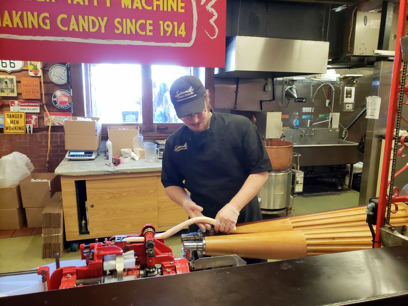
This morning Mary Margaret and I returned to Savannah, this time to spend time walking around and getting a bit more intimate with this beautiful town.  Yesterday, we learned that its population is only about 135,000 but it receives over 13, 500,000 visitors a year.  With about 1000 annual visitors per person who lives there, this has to be one of highest visitor/resident ratios in the US.


Despite being trampled on by so many visitors, the town handles them very well and still maintains a remarkable southern ambiance and charm.  Things move slowly here and a leisurely stroll, taking in the beauty is indeed, the best way to enjoy its beauty.


Our first stop was the Telfair mansion and museum.  When we took our trolley tour a couple of days ago, we learned that the Mary Telfair (1791 to 1875), the daughter of Governor Edward Telfair, who was also a Revolutionary War hero, was a remarkable woman, a believer in woman’s rights, and was way ahead of her time.  For example, after her death, her will provided for the founding of the Telfair Hospital for Females. It was a hospital which only employed women, including its medical staff, cleaning staff and administrative staff.  It only allowed women for its patients and if a birth of a male baby occurred, the mother and child could only remain for three days.  Such hard-core principles intrigued us so we thought we would visit the house she grew up in and has since become a museum and art gallery.

Telfair Academy

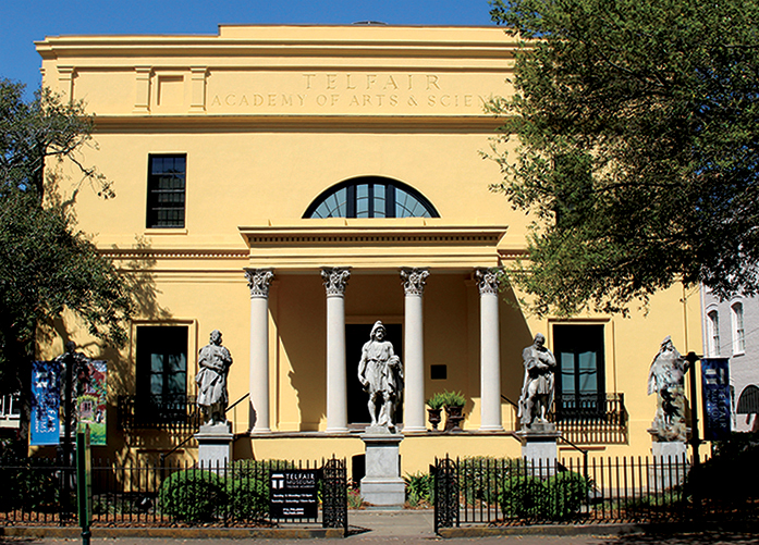
While there we learned that Mary Telfair grew up well educated and traveled.  During the nineteenth century, the expectation that a woman be an informed, vivacious conversationalist did not extend to knowledge of political issues.  Yet Mary Telfair formulated strong opinions on world and national affairs and openly expressed her convictions.  She once debated with James Moore Wayne, a U.S. Supreme Court justice, the merits of renewing the national bank charter. Her views on the subject were perhaps influenced by her friendship with Nicholas Biddle, the president of the Bank of the United States from 1823 to 1836.  Although she stood only five feet tall, Telfair was a formidable woman. When her last surviving brother died in 1832, she and her sisters took over the supervision of the family’s plantations, which were considerable.


During her repeated and extensive European travels, she collected many pieces of great art including casts of Greek and Roman statutes dating back to over 2500 years.  Many of these pieces are housed in the Telfair Museum and we were able to enjoy them first hand.Telfair Academy 2

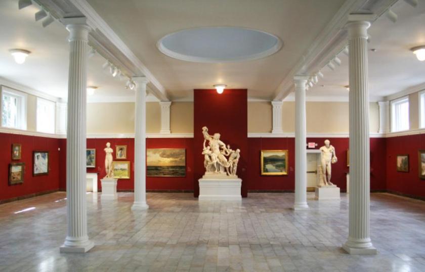
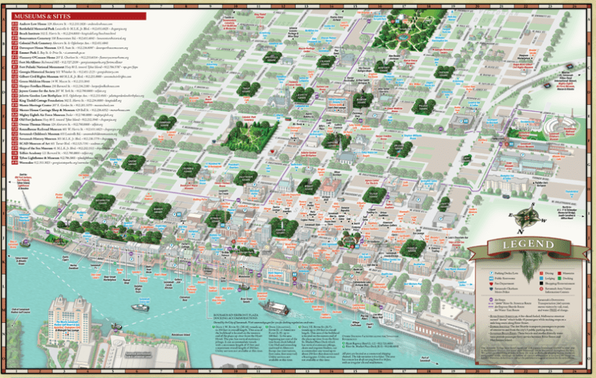
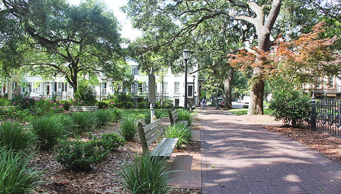
After our exploration of the Telfair Museum, we first strolled across the street to the Telfair Square and then went a few blocks further to the Franklin Square.  Each of the 22 squares that are within the Savannah historic district has its own theme.  The Telfair Square has claim to being the last of the four original squares to be laid out by Savannah founder, James Oglethorpe.  Oglethorpe constructed the square in 1733.  He originally called it St. James Square but is now named after the most influential family in Savannah’s history.


Franklin Square was built in 1790 and was named after Benjamin Franklin.   Franklin spent a great deal of time in Europe representing the Colony of Georgia before the British government in the years prior to the Declaration of Independence in 1776 and then later represented the 13 colonies to the French government trying to win financial and military assistance.


At the square’s center is a monument to the Haitian Volunteer Army who took up arms against the British during the Revolutionary War.  During the Siege of Savannah, a group of Haitians helped fight for American Independence.  This volunteer Haitian Army took up arms as colonial forces tried to retake the city from the British, who captured Savannah the prior year in 1778.  This effort is one of the more remarkable acts of military assistance by foreigners to the colonists seeking freedom from the crown.


We next strolled around the adjacent City Market but were not interested in its stores, which mainly catered to tourists.


We returned to our little Fiat and drove over to the far side of the historic district where The Olde Pink House is located.  It is across the street from Warren Square, named after General Joseph Warren, a General who fought in the American Revolutionary War.  General Warren died at the Battle of Bunker Hill in 1775.  Laid out in 1791, Warren Square was part of the first expansion of Savannah.  The Ward that contains Warren Square is smaller than many other Wards.  An interesting bit of information about Warren Ward; a number of the homes in the area of Warren Square were not built in the Square but moved to Warren Square from elsewhere in the city.


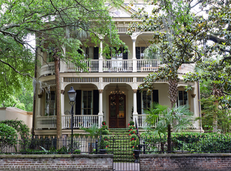
An example of one of the houses moved to this square is The Olde Pink House.  This Georgian mansion was built in 1771 for James Habersham Jr., one of Savannah’s most important early cotton families and founding-family members.  The lot was originally a land grant from the British Crown.  The building is a fine example of colonial architecture, and one of the few buildings to survive the fire of 1796.   Of particular interest is the Greek portico with a beautiful Palladian window above. The fanlight over the front door is one of the oldest in Georgia. The interior features a lovely but simple Georgian stairway.20180504_144413


The Bolton family, sister and brother-in law of architect William Jay, who designed the Telfair mansion, occupied the house from 1804 to 1812. Between 1812 and 1865, the house was home to the Planter’s Bank and First Bank of Georgia. It also served as headquarters for Union General Zebulon York in 1865.


The Olde Pink House is a popular destination for Savannah ghost hunters. Patrons of this restaurant and tavern claim to have found themselves in conversation with James Habersham Jr., who supposedly hanged himself in the basement in 1799. It is said that his restless spirit frequently wanders around his old home on quiet nights.


One of the earlier restorations, it is now home to an elegant restaurant and cellar tavern beneath.  The restaurant is well known for its romantic dinners.  We had made reservations to have lunch here and looked forward to its lowland, southern cuisine that it was famous for.


We were not disappointed as the fried chicken we enjoyed was the best we have ever had.  The coating was thick, crispy and delicious.  The meat was sweet and moist.  Man, was it good!  The baked mac and cheese was very tasty and the gazpacho which started the meal was wonderful.  The portions were very large which resulted in both of us taking half of our meal with us to enjoy later as dinner.


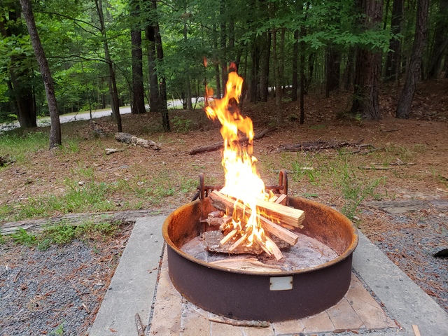
By now it was mid-afternoon and we were feeling a bit tired from the large meal and our morning strolls.  Thus, we decided to be creative in our route to return to our campsite and slowly cross-crossed our way through the historic district, taking pictures of squares and historic building from the window of our Fiat.


Tomorrow, we will be resting and getting ready for our drive up to Charlestown, South Caroline on Sunday.  We will be staying just outside of that city for a week, which will allow us time to leisurely explore that historic city.


Year 2 Day 123 Our Campground At Fort McAllister State Park


The campground where we are staying just outside of Savannah is rather unique.  Not only is it part of a National Historical Park, but it is isolated on an island in the middle of a saltwater wetlands area.  There is a narrow earthen causeway which connects it to the mainland but that causeway is over 1/2 miles long.  The island is reserved for camping but also offers a boat dock and boat ramp.  Plus, it has a wonderful nature trail where I spied a large white tail deer the other day.Aerial Photo Fort McAllister.jpg

There are 6 loops, 2 of which are dedicated to tent camping.  The other loops allow tent or RV camping.  Many sites are drive through, which makes entry and exiting very easy.  Specifically, you do not have to back into the site as you do in most campgrounds.  The campground also offers split firewood for sale at 10 pieces for just $5.  This is a very reasonable price.  The down side is the wood is green so to use it, you need to split it further into much smaller pieces.  Otherwise, you can not get it to light.20180428_164622

To better give you an idea as to how wonderful our campground and site that we are camping at is, I will post a few photo montages below.

Year 2 Day 122 Savannah, Georgia


We spent the greater part of today exploring the beautiful city of Savannah.  For years we had been told how beautiful this city was and after today, we definitely agree.  What makes this city so remarkable and unique are the numerous, large parks, which are locally called squares, which the city has grown up around.  Its founder, James Oglethorpe designed this town plan back when he originally laid it out in 1733.  Oglethorpe developed his town plan around a basic design unit which he called a ward. Wards were composed of four residential blocks and four civic blocks, arrayed around a central square. The residential blocks contained ten houses and each block was assigned a square mile tract outside town for farming, with each family farming a forty-five-acre plot within that tract.  Families were also assigned five-acre kitchen gardens near town.


The City of Savannah has preserved this ward design within its Historic District. Oglethorpe originally laid out six wards in Savannah. The design proved remarkably adaptable as the city grew, and city officials continued this same basic model for more than a century.  Ultimately, twenty-four wards were laid out in general accordance with the original design, filling most of the original square-mile town common.  Each square is unique, reflecting the ambiance created by each ward.Savannah-Business-Side


We had been warned that one walks a lot to enjoy the various squares.  Thus, we opted to spend the morning riding around this historic district on a tour trolley.  Thus, during the 90-minute tour, we saw each of the squares and the amazing number of historic homes and buildings that were breathtaking.  This allowed us to take everything in and start plotting where we would like to spend more time exploring.Monterey-Square Savannah GA

SavannahGA_whitehouse

Since it was now around 1 o’clock, we first opted for lunch at Joe’s Crab Shack on the edge of the Savannah River.  As we enjoyed, fried calamari, fried crab balls, steamed crabs, shrimp and sausage with corn on the cob and boiled potatoes, all washed down with a tall, cold beer, we watched the Georgia Queen, a paddlewheel tour boat ease down the river.20180502_132957


During lunch we decided to spend the rest of the afternoon enjoying the city’s museum and then return to Savannah on Friday to leisurely explore the historic district with its many squares and its historic homes.


As we strolled down the riverfront, we just had to stop in a cookie store and then a candy store.  The candy store was making the various goodies they had on display.  They had one area where a fellow was pulling taffy.  It was then fed into a machine that chopped it into individual pieces, wrapped in paper and the dropped into a chute, then slide down into a cart, was lifted up to an overhead conveyor, then slide down another chute and into a bin, where you could select the very fresh taffy.  It was a hoot to watch.20180502_144001


Armed with bags of cookies and candy, we returned to our car and drove over to the museum where we spent the rest of the afternoon.  We learned a lot of neat history about Savannah and Mary Margaret specially enjoyed the special room dedicated to Juliette Gordon Low, the founder of Girl Scouts.


We are going to spend tomorrow being lazy and then return to Savannah on Friday to explore some more.