Yesterday, we rested from our all-day outing at Gettysburg and got ready to leave our campsite. This meant running into the nearby town of Hanover to reprovision. Along the way, I stopped along the country lanes that are the main travel arteries in this area and took these pictures. The first is one of the many red barns that dot the countryside. 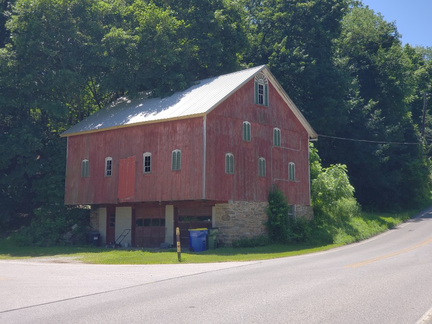
The other photo is of a little one room red brick school house that used to be a mainstay for education. 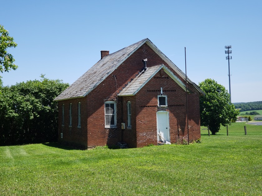 We have seen a number of these small school houses in our drives to Gettysburg. They have all now been replaced with modern campuses but are a nice reminder of what was so common in the last hundred years. MY grandmother, Helga, on my mother’s side taught in a school house similar to this in North Dakota during in early 1900s. Thus, every time I see one of these, it lights up a special place in my heart.
Today, we bundled up LeuC and headed down the road. Our next two campsites are located in the heart of what is known as Coal Country. While 25 states in the US produce coal, the biggest coal beds are in southwestern Pennsylvania and West Virginia. Today, we are staying near Confluence, Pennsylvania. Confluence is located at the juncture of the Casselman River and Laurel Hill Creek with the Youghiogheny River. Here is a copy of a 1900s era postcard that shows what this area looked like back then.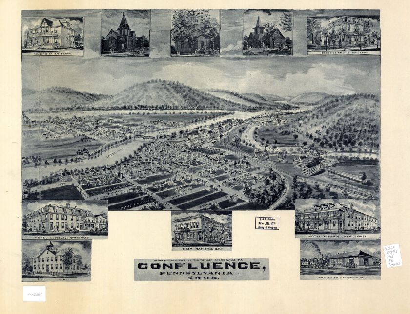
Now, the upper reaches of the Youghiogheny River are now dammed to ease the likelihood of downriver flooding. Since its completion in 1943, it has prevented flood damages estimated to be in excess of $569 million. Youghiogheny has the capability to store the equivalent run-off of 11 inches of precipitation from its 434 square mile drainage area. Since we have had almost of foot of rain in the last 6 weeks, you can guess that it is now bulging with water. In fact, as we wound our way over the curving country roads to get here, following the river valley, we saw that the river was at it very peak and, in places was flooding the low areas. This must be because the Corp of Engineers is releasing massive amounts of water that has been captured by this dam during this period.
We will be staying at the Corp of Engineers campground called Overflow, aptly named since we are just downstream of the dam and the overflow portion of the dam. As you can see from the Google Maps image I have captured, we are literally at the bottom of its emergency overflow that would channel the water out of the lake if it rose to top of the dam. Yikes!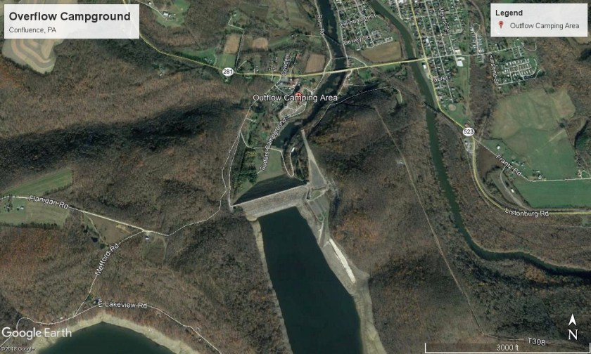
Fortunately, we are projected to have nice, sunny weather while we are here. Nevertheless, with all of the rain we have had, one of the first things I will be doing tomorrow is going over to the dam to check out how high the lake is. LOL!
After we setup LeuC, I walked over and met our neighbors. They are two couples who also have two of their children setup nearby. The ladies are sisters and they live just 30 miles north of Johnstown, which is about 30 miles to the north of here. One of the husbands, Jim, yesterday caught a 22-inch brown trout in the river here. He showed me a picture and it was a monster of a fish. He caught it using a nightcrawler worm. Needless to say, the fishing is great here!
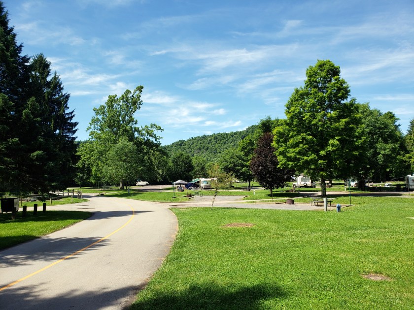
Our campground is just lovely with lots of green grass and a beautiful mix of evergreen and deciduous trees dotting the grounds. We are right along the Youghiogheny River and we can see it from our site. It is gushing by!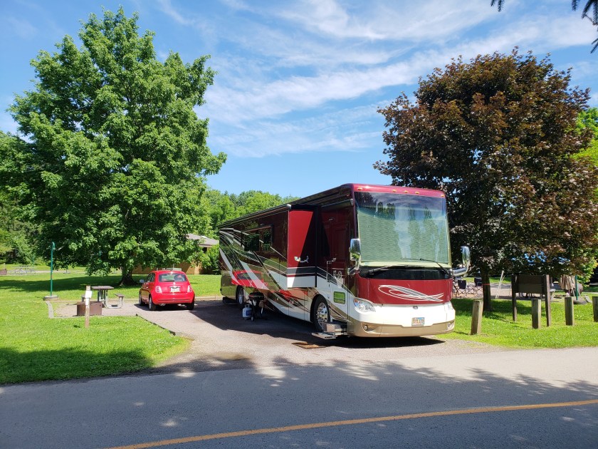


We will be here for 4 nights before we move on into West Virginia.
