Year 2 Day 121 Exploring Fort McAllister


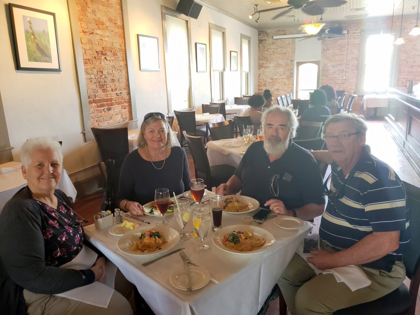
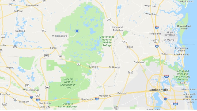
Due to a late start this morning, we opted not to go into Savannah today but, instead, stayed local and explored the museum and earthen fort that is here in our state park.  As it turns out, Fort McAllister was a key fort that played an important role in protecting Savannah during the Civil War.


Built in 1861 at Genesis Point, the fort was constructed on the plantation of Lieutenant Colonel Joseph Longworth McAllister, for whom it was named. Fort McAllister provided protection from the U.S. Navy for the southern flank of Savannah, about fifteen miles to the north, during the Civil War. It also afforded defense for the productive rice plantations of the lower Ogeechee River basin, and for the Savannah, Albany & Gulf Railroad Bridge, a key transportation link, farther upriver.


The earthworks, made up of mud and sand from the surrounding marsh, were designed by military engineers to absorb considerable punishment from Union bombardment. The fort was built chiefly for defense against naval attacks, rather than against a landward assault. Fort McAllister had ten large-caliber guns and facilities for the heating of “red-hot shot,” cannonballs that, when striking their targets, could set wooden warships ablaze.


Shortly after being built, General Robert E. Lee, then commander of the Confederate Department of South Carolina, Georgia and Florida, visited the site and made recommendations to its design that enhanced its ability to protect the waterway from attacking Union ships.


During 1862 and 1863, Fort McAllister repelled seven Union naval attacks by elements of the blockading forces offshore and in nearby Ossabaw Sound. Several of these attacks were made by the latest in naval warship technology, including the ironclad monitors USS Montauk and USS Passaic. One of the casualties of the Union assaults was Major John Gallie, Fort McAllister’s commanding officer. One of the cannon balls took off his head.  The fort sustained damage to its earthwork walls, but the guns of Fort McAllister managed to drive off the Union attackers each time they came upriver to bombard the fort. Blasted sections of the fort were repaired each night with dirt and marsh mud.


In early 1863 the Confederate blockade-runner, CSS Rattlesnake (formerly the CSS Nashville) took refuge in the Ogeechee River. After taking on a load of cotton, it was grounded on the mudflats not far from Fort McAllister. Union gunboats proceeded to fire on the Rattlesnake from long range across the marsh and eventually set her on fire. The Confederate vessel and its cargo were completely destroyed.


McAllister never fell to Union naval forces because of its unique earthen construction. This was in sharp contrast to the much larger and supposedly impregnable Fort Pulaski at nearby Cockspur Island, which fell after less than thirty-six hours of bombardment by Union forces using newly developed rifled artillery. Rifling, the addition of spiral grooves within a gun’s barrel, made these weapons especially effective against Fort Pulaski’s masonry fortifications.


It took a land-based attack by General Sherman’s army to defeat and capture Fort McAllister.  To complete Sherman’s “March To The Sea”, he had to capture Savannah and to do that, he had to capture Fort McAllister so the Union supply ships could come in and resupply his army before attacking Savannah.


The Union land assault on Fort McAllister occurred on December 13, 1864, with over 4,000 men attacking just 230 men defending the fort.  The battle was brief, lasting just 15 minutes but was very intense.  The key to the Union’s success was that they discovered that the palisades that lined the trench which surrounded the fort, did not extend past the high tide mark.  At the time of the attack, it was low tide which exposed a way around the end of the palisade and an easy way into the fort.  Federal infantry poured across this route and resulted in intense fighting within the fort.  Sherman observed the successful attack from a vantage point atop the rice mill of the Cheves Plantation across the river. Following the surrender of Major George W. Anderson’s force, Sherman and members of his staff landed at Fort McAllister by boat, and they made contact with the Union naval forces in Ossabaw Sound.


For the remainder of the war, Fort McAllister served as a prison for Confederate soldiers captured on the upper Georgia coast. After the war, the fort fell into ruin and remained so until the late 1930s, when it was restored as a historic site for the public through funding provided by Henry Ford, who owned the property at that time. Fort McAllister is now maintained by the Georgia Department of Natural Resources as a state historic park with a museum.


Here are the pictures that I took while we walked the fort which is in excellent condition.

These are the palisades that are sticking up inside a deep ditch that encompasses the land sides of fort.  However, since they stopped at the high tide line on the Ogeechee River, the Union troops were able to bypass them because it was low tide at the time of the attack.  This allow the Union troops to storm the fort without having to tear down the palisades with the potential resulting heavy casualties.

The is an earthen works fort, being made up of sides and mounds of mud and sand taken from the adjacent marsh.

One of the mounds housed the hospital, containing over 30 beds.


Other mounds houses the gunpowder and fuses used by the cannons.


There were a number of cannons placed in the berms that protected the fort.


The commander of the fort and his senior offices were housed here.20180501_141431

Year 2 Day 119 and 120 Savannah And The Cotton Gin: A Little History


Yesterday morning we bundled up LeuC and left the Okefenokee Swamp and its alligators behind us.  Our destination for the day was another wetlands area, this being the Fort McAllister State Park, nestled in the tidal marsh just to the south of Savannah, Georgia.  We will be staying there for a week, allowing us time to leisurely explore Savannah and its environs.


We have never been to Savannah but have always heard great things about it so we are anxious to explore it.  This area has played pivotal roles in the establishment of our country and its development.  In February 1733, General James Oglethorpe James Oglethorpe
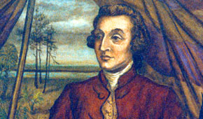
with 120 passengers on the English ship “Anne” landed along the Savannah River. Oglethorpe named the 13th and final American colony “Georgia” after England’s King George II.  The plan was to offer a new start for England’s working poor and to strengthen the colonies by increasing trade. However, its underlying political goal was to start the colony as a buffer zone for South Carolina, protecting it from the advance of the Spanish in Florida. South Carolina is located just across the Savannah River to the north.


Upon settling, Oglethorpe became friends with the local Yamacraw Indian chief, Tomochichi. Tomochichi
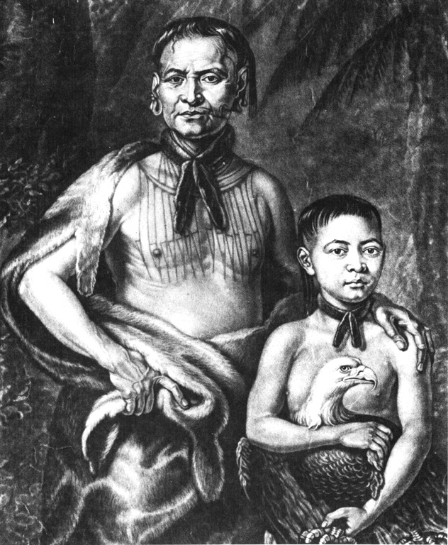
Oglethorpe and Tomochichi pledged mutual goodwill and the Yamacraw chief granted the new arrivals permission to settle Savannah on the bluff. As a result, the town flourished without warfare and accompanying hardship that burdened many of America’s early colonies.


Savannah is known as America’s first planned city. Oglethorpe laid the city out in a series of grids that allowed for wide open streets intertwined with shady public squares and parks that served as town meeting places and centers of business. Savannah had 24 original squares; 22 squares are still in existence today.Founding of Savannah

As Savannah grew, it proved to be a strategic port city in the American Revolution and later during the American Civil War. In 1778, the British took Savannah and held it until 1782. Eventually, a land-sea force of French and American troops reclaimed the city’s independence.


After this turbulent time, Savannah saw a long period of agricultural flourish.  With rich soil and a favorable climate, Savannah and its surrounding land became home to cotton and rice fields as plantations and slavery became highly profitable systems.


The cotton gin, an innovation created by Eli Whitney in 1794, made growing cotton so much more profitable, was invented on a plantation outside of Savannah.  Eli Whitney
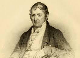
Upon graduation from Yale, in 1792, Whitney had moved from Massachusetts initially as a tutor but, upon his arrival, he discovered that his agreed upon salary was to be cut in half.  Thus, he rejected that position and accepted a position at the Mulberry Grove plantation outside of Savannah to read law.  There he met Phineas Miller, another Yale alum, who was fiancé and manager of the owner’s estate.  The owner, Catherine Greene, was a widow whose husband was the famous Revolutionary war hero, General Nathanael Greene.  He died in 1786 of sunstroke, leaving his wife to care for and manage the plantation.


Though green-seed cotton was widely available, it took hours of manual labor to properly clean the seed and extract the fiber. With widow Greene’s and Miller’s support, Whitney worked through the winter to devise a machine that was able to quickly and efficiently clean the cotton using a system of hooks, wires and a rotating brush.ctton gin

When Whitney demonstrated his new cotton gin (“gin” being short for engine) to some colleagues—with the device producing more cotton in an hour than what could be produced by multiple workers in a day—the reaction was immediate. Local planters took to the widespread planting of green-seed cotton.


Whitney and Miller patented the gin in 1794, with the aim of producing and installing gins throughout the South and charging farmers 40% of resulting profits. Their device was widely pirated, however, with farmers creating their own version of the gin. Whitney spent years in legal battles and by the turn of the century agreed to license gins at an affordable rate. Southern planters were ultimately able to reap huge financial windfalls from the invention while Whitney made almost no net profit, even after he was able to receive monetary settlements from various states.


Tomorrow, we hope to going into Savannah and explore a bit.  With the next blog I will try to post any pictures we take and continue with a little more of its history.


More From The Okefenokee Swamp And Other Tales (Tails)


I had forgotten that I had promised to post a video I had taken “up close and personal” of an alligator which shows how fast they can be.  So, here it is.

To spice up this short, little blog, I thought I would tell another “Leu You Idiot” story.  This one is about the time I was an undergraduate at the University of Michigan back in 1969 and drove down to Florida during spring break with some friends.  There were four of us: a fellow with his girl friend, another fellow and I.  We stopped at a visitor center at the Okefenokee Swamp because we had driven overnight and needed a break to stretch our legs and get a bite to eat.


After our meal we walked along the boardwalk and saw a place where they had canoes for rent and I came up with a “great idea”.  Since we were all poor college students, instead of renting a couple of canoes, why didn’t we just blow up our plastic beach rafts and simply drift down the same waterways the canoers took to enjoy the scenery.  Brillant!


Well, we did just that and in the process, got lost in the swamp.  We saw no one to help us find our way back so we just drifted and paddled our way around through the growth of cedar trees, water lillies and brush.  We never thought of the swamp being filled with alligators until we saw what we thought was a head slowly bobbing up and down ahead of us,  Gulp!


Fortunately, it was just a branch slowly moving up and down in the water due to the current.  Whew!  We eventually found our way back to the boardwalk by getting off our our plastic rafts (which were by now leaking air) and slogging our way through the swamp on  bare foot.  We arrived back at the visitor center safe and sound.  Another “Leu You Idiot” adventure completed!

Exploring Okefenokee Swamp: Photo Montages


We left the Okefenokee Swamp this morning and drove to the Fort McAllister State Park, within the great marshes immediately to the South of Savannah, Georgia.  I will write about this trip and this park later.  Since we now have marginal Internet, I will post the photo montages of our exploration of the Okefenokee Swamp that we did the other day.  The first montage is when I walked the boardwalk.  The other montages are of our tour of the swamp in a skiff.  You can click on each montage to see each photo in larger scale.  I hope you enjoy the photos.

Year 2 Day 118 Exploring Okefenokee Swamp


This afternoon we hopped in a flat bottom skiff to explore the Okefenokee Swamp.  The park offers swamp tours twice each day, once at 10 AM and again at 2 PM.  The tour lasted two hours and it was great.  As we explored the swamp, the ranger shared many insights regarding its morphology, history, and biology.  As we slowly cruised the lakes and canals of the swamp, we saw turtles sunning themselves of logs, a Barred Owl sitting on a tree limb almost in reach of us, the Great Snowy Egret, the minute Cricket Frog and, of course, lots and lots of alligators.


I took lots of photos, which I will post once we return to the land of better Internet.  While in the middle of this 700 square mile swamp, we have very poor Internet coverage.  It waxes and wanes, going from no bars to barely 1 bar of strength.


We learned that Okefenokee is a Seminole Indian word which means “land of trembling earth.”  They called this vast swamp land “okefenokee” because it is filled with wet peat and the peat shakes and vibrates as one walks upon it.


The swamp receives all of its water from rainfall, getting on the average about 50 inches of rain a year.  During years of low rainfall, much of the swamp’s water drains out by flowing down the Suwannee River to the Gulf of Mexico or the St. Mary’s River to the Atlantic.  This greatly lowers the areas of swampland covered by standing water and during years of drought results in swamp fires caused by lightning strikes.  The fires burn not only the standing trees but also burns the dried-out peat.  Peat fires can burn for months as they can tunnel through the peat, following paths of drier peat.  While the surface may become moist again from rain, below may be smoldering, only to appear once the surface dries out again.   The fire can also return to the surface by burning out the roots of trees and then follow those roots upward to the trunk.


Most of the old stand cypress trees were removed by logging during the first part of the 1900s.  Once the large cypress stands were removed, the logging company sold the swampland to the US government in 1937, which turned it into a national wildlife refuge.  The cypress trees are coming back, as you will see in the photos that I will be posting and are now just naturally thinned out by the periodic fires that I mentioned above.


It takes centuries for the cypress to reach their full height of about 150 feet.  Thus, most of the cypress forests that have returned are only about 50 to 80 feet tall.  Nevertheless, they are romantically beautiful with their trunks standing in water and their limbs draped with Spanish Moss.


We followed the meandering waterways that cut through the shadowy cypress forests, many times just drifting in the slow current.  This allowed us to get up close to a number of animals as we drifted by.  We followed a Great Snowy Egret as he hopped scotched down the waterway, repeatedly flying a short distance and then landing.  We finally passed him by as it was standing on his long legs right in front of a huge alligator resting on a log.


We also learned that alligators are opportunistic feeders.  They just lie very still, waiting for some animal to wander close by.  When the soon-to-be-food is within range, the alligator lunges forward, snapping up its prey with its large, teethy mouth.  I captured one huge gator quickly flipping itself away from us as we got within inches of him and will post it so you can see how fast these beasts can move.


We also learned that the swamp is filled with meat-eating plants. These meat-eaters include the Pitcher Plant, the Sun Dew Plant and the Bladderwort Plant.  Our ranger dipped his hand into the swamp water and scooped up a handful of Bladderwort to show us up close and personal.  Bladderwort’s leaves have small air sacs or bladders in which minute water creatures such as larvae, nematodes, water fleas, protozoa, and small worms are trapped. Each bladder has a small opening through which the tiny animal can enter but cannot escape. Eventually the trapped organisms die and their bodies decompose to be absorbed by the plant.


I am afraid this blog is a bit dry without the pictures I took.  However, I am sure you will enjoy the montage I will be putting together and sharing once we have better Internet.


Tomorrow will be a rest day as we enjoy our last day here in the swamp.  Well, it will be a rest day for me as Mary Margaret wishes it to be a laundry day.  She is clever in how she schedules the laundry days.  Most places we stay out do not have a direct hookup to the sewer.  Thus, she marshals our grey water production so that she usually does our laundry the day before we leave where we are at.  That way, our grey water tank is near full when we leave.  On our way out of the park, we pull up to the sewer dump station and empty our grey and black water tanks.  Thus, we arrive at our next park with empty tanks.  We can usually go about a week to 10 days before we need to empty our tanks.


Tomorrow, we will be heading off to Fort McAllister State Park, located along the shores of the Ogeechee River, just to the south of Savanah, Georgia.  It is where General Sherman defeated a Confederate force manning the fort which protected Savanah.  This was the last phase of his “March to the Sea”.  His forces followed a “scorched earth” policy, destroying military targets as well as industry, infrastructure, and civilian property and disrupting the Confederacy’s economy and its transportation networks.  His march is credited with breaking the back of the Confederacy and ultimately led to its defeat.

We will be staying there a week, which we hope will give us enough time to explore that beautiful and historic city.


Year 2 s 116 and 117 In The Middle Of The Okefenokee Swamp

*******************************

Note: I am not sure this will post since our Internet is very weak to non-existent.  I am keeping my fingers crossed that it will go through…

*******************************

Yesterday, we bundled up LeuC and drove just an hour north.  Our next stop was the State of Georgia’s Stephen Foster State Park which is situated smack dab in the middle of the largest blackwater swamp in North America.  To get here, we had to drive up a two-lane road that was marked as “dead end” as soon as you turned onto it.  It went on for 16 miles.  We are located where the little blue dot is shown below.Okefenokee Swamp Map


Once we were on this dead-end road we passed through a rolling security gate which marked the beginning of the Okefenokee National Refuge.  The swamp is mainly enclosed within this national refuge which protects this remarkable preserve for future generations.  It also protects the various species which reside here including 621 species of plants, 39 types of fish, 37 kinds of amphibian, 64 species of reptile, 234 types of bird, and 50 mammal species.


Wildlife species include wading birds such as herons, egrets, ibises, cranes, bitterns.  Other animals include raccoons, river otters, bobcats, red foxes, boars, minks, white-tailed deer, gray foxes, striped skunks, toads, frogs, turtles, lizards, snakes, woodpeckers and songbirds. The most notorious animals that the Okefenokee Swamp is renown for are its Florida black bears and tons of alligators.


We quickly knew we were heading into the deep, dark, dangerous, forbidden nether regions of this dismal swamp when we spied a very long snake slivering across our path.  It was black with bright green bands.  We had never seen this type of snake before and had to move over to the other lane to miss running over it.  Yep, we were now in their world, not ours!


Many swampy miles later, we drove onto a low sandy island which is the state park we would be staying at.  It is an isolated haven of relative safety in the heart of the swamp. It is covered with tall yellow pines, a few hardwoods and ringing around it are numerous swamp cypress trees covered with Spanish moss.


The ranger station was closed and abandoned so we made our way to the campground and squeezed LeuC into a site that was long enough but was narrow due to the tall pine trees around it.  It was the first site we could squeeze into.  We did not want to go deeper into the campground because the road we were on was very narrow and curvy.  We had to ease our way past some pine trees just to get to this site.  There is hardly anyone camping here this time of the year so it looked to us that we had our pick of the sites.


Once we leveled LeuC and put out her slides, I returned to the ranger station to see if I could find the park ranger and check in.  When I did find her, I learned that there were some other sites we could have had that are for large rigs such as LeuC but in a different part of the campground.  I opted to stay put since we were now all set up and comfy.


When I returned to Mary Margaret and LeuC, we discovered that the Internet was ephemeral.  At times we could barely get one bar of strength but most of the time there was no coverage.  We had not given it a thought as we drove in but it really makes sense since we are ringed by the national refuge which would not allow cell towers to be built.  We must be around 15 to 20 miles from the nearest tower.  Plus, with our campsite site in the middle of a pine forest, we have no satellite coverage.  It reminds us of being back on our sailboat, out in the middle of the ocean.  Since we lived for 10 years without TV and iffy Internet coverage, it is not a really big deal to us.


Today, I went to the ranger station to see if I could buy some firewood.  While there, I went for a walk along the boardwalk they have built which allows you to go about a ½ mile out into the swamp.  I took a number of pictures and will try posting them once we have good Internet so you can get an idea of what I saw.  During my walk, I came across two white-tailed deer munching on some ferns just 50 feet from me.  Since they are protected, they were not scared and just gazed while I watched and took pictures.  So cool!


As I made my way back to land and the ranger station, I passed by a small boat basin where you can rent little skiffs to go fishing.  Smack in the middle of the boat basin was a 12 to 13-foot long alligator just floating on the surface, soaking up the sun.  Whoa!   He was a monster!


Tomorrow, Mary Margaret and I hope to take a boat tour of the Okefenokee Swamp.  I will be sure to take our camera!


Year 2 Days 110 to 114 Energizer Bunnies


We spent our last few days with Larry and Ruth trying to keep up with the high energy they enthuse in the various activities they do.  They both reminded me of the icon for the Duracell battery, the Energizer Bunny.Energizer-Bunny-300x270


Before we left, they spent our last two days keeping us fully entertained by including us in a number of activities.  This included Larry taking us to the Florida Caverns State Park where we went on an Earth’s Day guided nature walk while Ruth cooked up a storm for a party they hosted that night for the horticultural club they belong to as a way to say “thank you” to their local agricultural agent who will be leaving shortly.


Then, the next morning, we walked to their church, where we participated in its weekly Sunday morning breakfast which is held each week as part of their support of the local community.

Did I also mention that between all of these activities, Ruth found the time to bake and serve to us the absolutely best Key Lime pie that I have had in over 50 years?  I had mentioned in passing to her that I had tried various versions of this iconic Floridian dessert all over the world but none of them stacked up to the very first time I had a slice down on Marathon Key in the Florida Keys as a kid growing up.  I shared with her that maybe my memory was playing tricks on me since my recollection of that very first taste was just so much better than anything else I had tried since.  Ruth said she had a very old recipe that she wanted to share which might come close to what I had enjoyed as a kid growing up.  OMG, she was right!  The tartness of the key lime filling, the tall sweet, fluffy meringue topping, all sitting on a graham cracker crust far exceeding my expectations.  She matched my memory of this delight perfectly.  What a treat!20180420_200606

After our church breakfast, we sadly said our goodbyes as we hopped into LeuC to drive east to the Stephen C. Foster Cultural Center Campground.  Our plan was to stay there for a few days to learn a bit about this 1800’s song writer and discover why the State would build this huge park to celebrate him.  This was a mystery to us, especially because Foster never, even lived or visited Florida.  Go figure.


We arrived right before a huge front blew into our area, bring with it lots of rain and wild winds.  We spent the next day hunkered down as it rained for 24 hours.  We later learned that Mississippi, Alabama and North Carolina all suffered tornados as this massive front moved through.


Today, we peeked out our windows and discovered that the sun was shining and that we had survived the storm just fine.  Thus, we decided to run over to the park’s museum and learn about Stephen Foster.  I must say, the museum was pretty strange.  Here was this massive building that had only a few exhibits and a handful of dioramas of scenes from the 1800 era songs that Foster wrote.  Weird!  Stephen Foster Museum
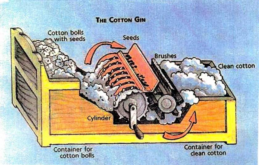
There were no docents in the building so we were on our own.  As we rambled through the museum, we learned that Foster wrote over 200 songs; among his best-known were “Oh! Susanna”, “Camptown Races”, “Old Folks at Home” (also known as “Swanee River”), “My Old Kentucky Home”, “Jeanie with the Light Brown Hair”, and “Beautiful Dreamer”. Many of his compositions remain popular more than 150 years after he wrote them. His compositions are sometimes referred to as “childhood songs” because they have been included in the music curriculum of early education.  This I can attest to this because I played many of these songs as a little kid on our little 78 rpm record player back in the 1950s.


Foster grew up in Pittsburg, lived a while in Cincinnati, Ohio and died in New York City at the age of 37.  Foster had become ill with a fever in January 1864. Weakened, he fell in his hotel in the Bowery, cutting his head and neck. His writing partner George Cooper found him still alive, naked, lying in a pool of blood. He died in Bellevue Hospital three days later.


Apparently, because of his song “Swanee River”, Florida embraced Foster and built this park and cultural center to capture the memory of the pre-civil war era.  Who knows for sure because this “museum” was one of the strangest things we have ever been to.


The park itself is beautiful and the Suwanee River (it is actually misspelled in the famous song) does flows through it.  Here are the pictures that I took.


Tomorrow, we drive north into the Okefenokee Swamp, which is the source of the Suwannee River.  We will be staying in the Sate of Georgia’s Stephen Foster State Park to explore this wetland that is filled with alligators.


Year 2 Day 109 Ice Cream And Oysters


This morning we got up early so we could go shopping for one of the many treats that is renowned in Marianna: ice cream!  Yep, as lovers of ice cream, we just had to load up with this delicious frozen concoction while the getting’ was good.


Larry and Ruth last night had treated us to some ice cream from the national award-winning ice creamery that is located just a few blocks from their house.  Called the Southern Craft Creamery, it is literally a small mom and pop creamery where they take the milk and cream they collect from their dairy farm nearby, bring it to their little shop, and make some of the most fantastic ice cream we have every tasted.  They only make small batches, each being 20 or so gallons and then fill pint size containers.  What makes their ice cream so different is that they do not homogenize their cream.  Thus, the milk fat globules remain large so the rich milk fat coats your tongue allowing the flavors to be absorbed so well and that makes the ice cream’s texture so unique.


They also are very creative in the flavors of ice cream they produce.  Larry and Ruth had shared with us the Buttermilk, Salted Carmel and Sweet Potato-Praline flavors last night.  After rolling our eyes in simple delight, we just had to sample some more.


Therefore, early this morning Larry and I waltzed over to the ice creamery and load up with a bunch more containers.  Below is what we got and a brief description of each flavor:

Roasted Banana with Salted Peanuts – Salted peanuts and rich cream compliment sweet bananas roasted in butter and brown sugar,

Salted Dark Chocolate – The perfect pairing of sweet and salty folded into rich, dark chocolate (chocolate: French Broad Chocolates),

Butterscotch – Inspired by their Mama Elsie’s perfect butterscotch pie recipe that she lovingly passed down to them,

Raspberry Basil – Raspberry compote highlighted with sweet basil dolloped into sweet cream with a little Meyers lemon juice, combine for a deliciously aromatic flavor,

Blackberry Buttermilk – The unique buttermilk ice cream flavor is accented with the finest blackberries.


Their little creamery is Nirvana!


Once our treasure trove of sweat icy goodness was safely tucked away in Larry and Ruth’s freezer, the four of us hopped into their extended cab pickup truck and headed down the road.  They wanted to show us some of the beauty of their area and to share with us their very special retreat: Apalachicola.


Apalachicola is located about 80 miles south of their house and is where the Apalachicola River meets the Gulf of Mexico.  It is famous for the succulent oysters that are farmed in Apalachicola Bay.  We all love oysters so this outing was going to be a real treat.


We arrived just in time for a little walk-about before lunch, allowing us to explore the little town with its restored old buildings and beautiful views of the mouth of the Apalachicola River.  We went inside a very nice galley where we learned about shotgun houses, a unique style of house which typically consisted of four rooms that were each connected by doors leading directly into the next room.  There are no hallways in these houses.  The shotgun houses of Apalachicola were built primarily for mill workers, oystermen and workers in the shrimp canneries and were early examples of affordable housing.  They are called shotgun houses because it was said that you could fire a shotgun into the front door and all of the pelts would pass through the other doors and exit out the back of the house without damaging the house.20180419_124655

After our walk-about, we then went to the Owl Café where we had a wonderful seafood lunch consisting of fried oysters, crab dip with flour tortillas, and sautéed flounder over a bed of angel hair pasta with lobster sauce.  The meal was made complete with pecan pie topped with vanilla ice cream.   Oooooh, it was goooood!20180419_134846


After wiping our mouths, we waddled back to the car where Larry and Run gave us a drive-by tour of the rest of the village and then off we went to the nearby St Joseph’s Bay and onto the very thin finger-like peninsula that separates the bay from the Gulf.  Once there, they showed us the beach house they rent each March and then took us to the state park at the end of the peninsula.  The views of the bay and the Gulf beach were wonderful and we just had to walk the sugar white sands of the beach.  It was great and we talked about how much we enjoyed and missed our years of living on our sailboat and sailing around the world.  Ahhh, such great memories!


By now it was late in the afternoon and we had just enough time to swing by Larry and Ruth’s favorite oyster shack before heading back home.  We ordered two dozen oysters, prepared two different ways: steamed and baked with a parmesan topping and a dozen shrimp stuffed with crab meat.  Paired with a seafood dip and crackers, we were in seventh heaven.  None of us could figure out how we could eat again so soon and were amazed at how fast the oysters, stuffed shrimp and seafood dip disappeared!  Yum!


When we returned to Larry and Ruth’s historic home, we made a bee-line to the freezer and hauled out the five containers of ice cream that we had stashed away this morning.  They had been calling to us during our return trip to their house.  What a wonderful way to close a wonderful day!


Tomorrow, Mary Margaret and Ruth will be spending the day cooking for a party that Larry and Ruth are hosting Saturday night.  I will spend my time washing and waxing LeuC while Larry is off being a mediator for a case in the State’s civil court system.  Larry and Ruth are both retired lawyers and Larry enjoys spending some of his retirement being a court appointed mediator.


Year 2 Days 107 and 108 Larry And Ruth


We left our lovely wooded Corp of Engineers campground just outside of Montgomery, Alabama yesterday morning and continued driving south toward Florida.  It was a beautiful day with lots of sun and temperatures hovering around the high seventies.  Maybe spring has sprung and the rest of April will be nice.  We sure hope so.


Once we arrived in Florida we turned east and followed State route 73 about 15 miles and entered the little hamlet of Marianna.  It was the site of a little known but very significant Civil War battle.  It fact, it occurred right in front of Larry and Ruth’s house, which was our destination.


In September 1864 a force of 700 Union soldiers, including the mounted Buffalo Soldiers, a renowned group of black cavalry, entered Marianna, trying to determine how significant the Confederate forces were.  General Sherman was marching south through Georgia and in that effort, was destroying everything in his path as he attempted to divide the South.  He needed to know whether he should turn east and move toward Atlanta or continue south and enter Florida in search of the Confederate forces.


The union troops marching through the pan handle of Florida were searching for Confederate troops to provide information of their strength for General Sherman.  The Battle of Marianna convinced the Union forces that the bulk of the Confederate troops were up near Atlanta so, as a result of this battle, Sherman turned east and attacked Atlanta.


During the Battle of Marianna, the local Confederate troops were routed, however, a number of buildings were destroyed and the mansion where Larry and Ruth live was struck by numerous bullets and a cannonball blew a hole its roof.  This house, which Larry and Ruth have restored, was built in 1840 and is known as the Ely-Criglar Mansion is one of Florida’s most beautiful antebellum homes.  During the Reconstruction era, freed African Americans held political rallies in the pecan grove behind the house. The home is on the National Register of Historic Places.


When we arrived, we had to park LeuC across the street, behind a restaurant so that we and Larry could figure at a way to bring LeuC onto their property.  Their driveway is very narrow with palms and other trees lining the driveway.


However, after pacing the driveway and measuring its width in numerous places, we decided we could squeeze in if we tied back a number of palm fronds and cut a few of them down.  With this done, I hopped into LeuC and brought her over.  Mary Margaret directed me in and soon we were safe and sound in Larry and Ruth’s backyard.


After hugs and kisses we received a tour of their remarkable house and beautiful grounds.  Wow!  It was like stepping back in time and being in the 1850s.  I will let the photos I took do the talking as my words would not do justice.20180418_110000


Year 2 Days 105 and 106 On The Road Again. Whoo Hoo!


After spending a bit over three weeks at the Tiffin Service Center in Red Bay, Alabama, we are finally on the road again.  Yippie!  This morning, for the last time, we bundled up LeuC and drove over to a service bay.  This time it was Bay 44, where the Diamond Shield technician applied his clear protective sheeting onto our right front quarter panel which had recently been repainted.  This was the quarter panel that was hit but a big, burly mule deer way back in September of last year.  At that time, we did not notice any damage to that panel but it was later discovered to have a few, almost invisible, micro-cracks in the fiberglass.  Most of LeuC’s exterior is fiberglass, much like the hulls and decks of our beloved sailboat, Leu Cat.  This makes for a very strong, flexible but light exterior for our bus.


Also, when the deer hit that panel, it must have loosened the bolts holding it onto the bus’s frame because after driving many thousands of miles after the deer was hit the panel had moved just a fraction of an inch.  I say this because when we were in Baton Rouge last month the steps that automatically slide out when you open LeuC’s door, caught on the edge of the panel and cracked it.  Ouch!  Thus, while in Red Bay we had this quarter panel re-fiberglassed, repainted and then a new Diamond-Shield applied.  The amazing thing about this work was that the Tiffin people insisted that they not charge us for this work!  We had told them that we thought the repairs were all tied to the fact that the deer hit us but they said that since the power door step caught on and cracked the panel long after the deer hit us, it would be covered under warranty.  Whoo Hoo!  I am not sure how much this saved us but we were in the paint and body shop bay for three days and it took another 3 hours this morning for the Diamond-Shield technician to do his work.  At $95/hour, the labor charges would have been significant.


In general, we were very impressed with the Tiffin people we worked with during our stay at their service center.  The vast majority of issues they worked on were covered by their warranty.  We ended up only paying for the rear ladder we bought and had installed and the replacement and painting of four side panels that I had scratched while driving on a very narrow curvy road in the Rocky Mountains of Colorado.  Going around a tight hairpin curve, I pressed the side of LeuC up against a side rail for a brief second.  The replacement of these four panels, their installation and repainting, along with the new ladder and its installation only cost me $2,500.  I had visions of the costs going as high as $10,000 and had budgeted for that expectation.  What a wonderful surprise the actual costs were.


I compare these costs to our typical costs of annual maintenance costs and retrofitting costs of our sailboat, Leu Cat, after each major ocean crossing.  We averaged about $5000 a year for general maintenance and about $25,000 for the each of the 5 retrofits we did after crossing the Carrageenan, Pacific Ocean, Java and South China Seas and the Atlantic Ocean.


On top of that, our 24 days of staying at the Tiffin Service Center campground and sucking up their 50-amp power, guzzling down their water and using their disposal sump was all free!  Double Whoo Hoo!  We must admit, we are very impressed with the Tiffin Company and their dedication to make our RV home the best they can.  While we were there, we talked with many other RVers and listened to the horror stories they had experienced in previous motor homes built by other manufactures.  They all agreed that Tiffin stands behind their product better than any other company on the market.  Our experience here confirms that.


Even though we are very impressed with and grateful to Tiffin for the quality of services provided and their commitment to making our experience the best, we certainly were ready to leave after 24 days there.  Their campground is basically a huge RV Park and we just are not RV Park people.  Most of the people we met there were very nice but, after a while, people tended to drift into cliques, including those that shared their values and excluding others that did not. While we did tend to socialize with a particular group of people that we enjoyed being with, Mary Margaret and I really enjoy mingling with all types of people.  This allows us to better understand the basis behind peoples’ views and beliefs and exposes us to all kinds of different perspectives.  However, given how polarized and tribal the US has become, we found a few of the cliques were just not interested in our views since we tend to be on the more “liberal” side of the spectrum.  At times it seems like you are walking on egg shells in your efforts not to point out the various myths or lies that one fraction or the other are professing to be the truth.  Thus, with that in mind, we were anxious to get on the road again and continue our adventure of exploring North America.


Today, we drove 4 hours and arrived just west of Montgomery, Alabama.  Our day’s destination was the Gunter Hill Corp of Engineers campground.  Since we were not sure of the exact time of our departure from the Tiffin Service Center, we did not make a campsite reservation.  However, I had research this campground and knew that it was mostly empty and we could just walk right in.


From our research, we knew this was going to be a lovely park and this was confirmed with our arrival.  Tucked in the middle of a beautiful oak forest, nestled up along a river, the campground was just the reprieve we have been looking forward to.  I will let the photos I took show you how beautiful it is.

20180416_170431


Our only regret was that we were only spending one night here since we are anxious to arrive tomorrow in Marianna, Florida, where our former brother-in-law, Larry, and his wife, Ruth, live.  However, we did vow that if we come back this way again, we will be sure to stay at this park for much longer so we can explore it and really enjoy all that it offers.