Year 2 Days 196 and 197 Lake Michigan

Yesterday was a sweltering 94 degree.  It was so hot that we decided to just hunker down and rest inside cool LeuC.  We were thinking about going into Ann Arbor and touring U of M’s central campus a bit, allowing us to reminisce about the years we went to school there.  It was very tempting but with no breezes to cool us down some and with humidity creeping into the very uncomfortable level, we opted out.  We will be returning in mid-September, when we will be flying in to attend a football game and will then tour the campus.


Today, we bundled up LeuC and headed down the road again, this time with Lake Michigan as our destination.  Specifically, we will be spending the next 5 days at the Van Buren State Park.  It is located just south of South Haven, along the southeastern shore of Lake Michigan.


The drive was a snap, with the vast majority of it along freeways.  It was only 2.5 hours long and we arrived before 1 PM.  This allowed us time to walk to the beach once we set up LeuC.  The campground is located behind tall sand dunes that have formed since the last glacier retreated for the area about 10,000 years ago.  They are wind generated and in a later blog, I will explain how they form.fixedw_large_4x


Fortunately, a path runs between two adjacent dunes, allowing easy access to the beach.  Here is what we saw:


If one does not live around the Great Lakes, you probably have no idea how “GREAT” and unique they are.  Five lakes which make up the Great Lakes.  As I learned in third grade, the first letter of each of the lakes spells “HOMES: Huron, Ontario, Michigan, Erie, and Superior.  The five lakes, which are interconnected, make up the largest body of fresh water on Earth, accounting for one-fifth of the freshwater surface on the planet at 6 quadrillion gallons. The area of all the Great Lakes is 95,160 square miles and span 750 miles from west to east. The square mileage is larger than the state of Texas.


Now I have a hard time understanding what 6 quadrillion gallons of water looks like.  I understand what a quadrillion is.  It is a thousand trillion or 1,000,000,000,000,000.  But what does that amount of water looks like.  After a little research, I discovered that with this amount of water, you could cover the land mass of the United States with 9 feet of water.  Wow!  Plus, it is all crystal clear, fresh water.  Double Wow!!


We plan on going to the beach here each day to swim, sun bath and r-e-l-a-x.  Ahhhhhhhhhhhh.  It will be great!


Year 2 Day 195 So Long Ago…Continued

Yesterday, I wrote about Rich, who I shared a dorm room with me back in 1968 while attending the University of Michigan. He and his wife, Joy, had spent that afternoon visiting us at our campsite near Ann Arbor. It had been decades since we had last seen each other.

Today, the trip down memory lane continued as Mary Margaret and I decided to drive over to what is now the Colonial Square Cooperative to see where we lived during our first years of marriage. We were married in late August, 1971 and received notice the day of our wedding that our application for a townhouse unit had been accepted. Whoo Hoo! Just in the nick of time. We had submitted our application in March and it took this long for a unit to open up.  Prior to receiving that notice, we had no idea where we would be living once we returned to Ann Arbor after our 1 week camping honeymoon.

We had been turned down by the University of Michigan regarding our application for an apartment unit in their married housing complex. We were informed that we were not poor enough. Our net wealth at that time was -$500 and we were not poor enough. Go figure!

Fortunately, we were poor enough to qualify for a 2-bedroom, 960 square foot townhouse unit in the newly opened low-income housing project called Colonial Square, located a few miles to the southeast of the University. Our notice of acceptance stated that we could move in during the first week of September, which was perfect. We would be returning from our honeymoon then and would have a week to move in before classes would start at the University. Whew!

We lived in the Colonial Square townhouse for 4 years. Our rent started out at $78 a month for the two-bedroom unit, that was two stories and had a full basement.20180714_145426

The unit also opened up to beautiful woods just behind our backyard.20180714_145625

After our first year there, our rent went up to $99 a month because the rent amount was based on our income. Once we were married, we decided that since I was a year in front of Mary Margaret, I would go to school part time and work full time, while Mary Margaret would go to school full time and work part time. That way we would both graduate at the same time and generate some income to live on. Our first year we made a whopping $7,000 and which allowed us to squirrel away a few hundred bucks in the bank. At that income level, we were moved into a higher rent level.

We ended up living in our townhouse for 4 years. During that time, we both graduated and then continued on with our Masters Programs. In 1975, I was accepted into the University of Delaware’s Ph. D. program in Marine Engineering and that summer we moved out of our beloved townhouse.

When we went there today, we were surprised to see it how well it was kept up. It was no longer a government controlled low income housing project but was now a cooperative. I believe that means that it is owned by those who live there and the cooperative’s governing board sets the rent requirements.

After seeing the old place and reminiscing a bit, Mary Margaret and I then drove to Tanglewood, an upscale neighborhood that is just to the northeast of Ann Arbor. Less than a mile from UM’s East Medical Campus, it is a nestled in a forest and each house sits on ample sized lots. We had made arrangements to tour a house that is for sale. We met the real estate agent. After inspecting the house, we shared with her that we are interested in finding a house in the not too distant future. Since we had loved Ann Arbor, it was one of the places we wanted to check out.

This particular house met all of our criteria: it sat on a 1.7-acre lot, was on a quiet col de sac, had 4 bedrooms and 3.5 baths that would accommodate visits from our kids and grandkids, was spacious and comfortable (this particular house has 4,600 square feet) and was close to the University. This last criterion was important to us because the University has great plays, musicals, concerts, lectures and sporting events throughout the year. Plus, being a college town, it has a forward-thinking attitude and culture but accommodates more traditional and conservative values as well. As we discovered later, Ann Arbor has been also listed as one of the best communities in the US to retire to.

We enjoyed our house tour and, if we were actually ready to buy, this house would be at the top of the list. However, we still wish to inspect other areas of the US before we are ready to give up the nomadic lifestyle we are enjoying now.

Year 2 Day 194 So Long Ago …

One of the great things of living and traveling in an RV is that you get to visit with family and friends that you may not see very often. That certainly was the case today. Rich, who was my roommate at the dorm we lived in during our freshman year at the University of Michigan, way back in 1968, came to visit us at our campground here at the Brighton Recreational Area. He and his wife, Joy, arrived mid afternoon. As they stepped out of their SUV, I was surprised to see that they had hardly changed after all of these years.20180713_163944

20180713_164036-001

I had forgotten but Mary Margaret had remembered that the last time we visited was about 20 or so years ago when Rich came to visit us when we lived in Southern California. When she mentioned that, the memories of their visit flooded back to me and a smile crept on my face as I remembered the great time Rich and I had playing golf together.

Mary Margaret has such a great memory and has many times pulled facts out of the air of things we had done so many years ago that it just amazes me that she can retain such details from our very active and full lives. Another memory she shared with us was of when we visited Rich and Joy at their house way back in 1979 when we were living in Delaware. Rich, Joy and I were dumbfounded by the details she shared with us about that visit. As she went into the details of that visit, including how close in age our respective babies were, a dim memory of Rich and Joy’s house came back to me. We had spent only a couple of hours together as we were driving to Kalamazoo to visit with her parents. Nevertheless, that visit was well retained in Mary Margaret’s memory. Wow!

During Rich and Joy’s visit we had a chance to catch up a bit and share what we each had done with our lives. It was wonderful learning all of this and sharing old memories of time shared during university days. We also talked about the friends we had back then and what we know of them today.

Rich and I both grew up in the Okemos/East Lansing area but did not go to school together nor did we know each other. However, we did share friendships with some of the same people. Thus, Rich and I had a fun time rattling off names of old friends we shared and talking about what we knew of their current status. It was great!

Since we are staying in a recreational area, we all decided to continue our discussions while we explored the area around our campground a bit. We found a trail that led through the woods and followed it to Lake Bishop. During our hike, we continued talking about our pasts and friends we once knew. Along the way we stumbled on a fat green frog sitting on the trail. We learned that Joy has a hobby of learning about frogs as she gently moved the frog into the shade of the forest around us. She is a gentle soul who has spent her life caring for and helping others.

All too soon it was time for Rich and Joy to leave. We so enjoyed their visit and were sad to see them go. However, their short time with us was great and we greatly appreciated their making the effort to come and see us. We are hopeful that it will not be so long before we can get together again.

Year 2 Day 193 Michigan


It has been a couple of weeks since I have last written our blog. During that time Mary Margaret and I were back in the San Francisco Bay area attending a wedding and spending some time with our daughter, Heather, our son, David Paul, his wife Allison and their children. We had a wonderful time and filled our life’s bucket with tons of great memories. It was a hoot to see how much little Victoria and Molly are developing and growing. We look forward to November, when we will be driving LeuC down from the state of Washington, to spend Thanksgiving with them all.

We returned to where we left LeuC, just outside of Columbus, Ohio earlier this week and spent one night recovering from our overnight flight before bundling up LeuC Tuesday morning and striking out for Ann Arbor, Michigan. Most people don’t know that while I was not born in Michigan, I have spent more time living in Michigan than any other state. My parents brought their young family here in 1953, when I was three years old. We lived in the East Lansing/Okemos area for 15 years while my dad first went to Michigan State University to receive his Doctorate in Education Administration and then stayed as a professor there in their College of Education. He also served as Deputy Supernatant of Education for the State of Michigan in 1957. In 1968, when I graduated from high school, I went to the University of Michigan, where I received my BS and then MS degrees from the College of Engineering. During that time, I met and married my life mate.

Mary Margaret spent her formative years growing up in Kalamazoo, Michigan. She was born in South Bend, Indiana but her parents brought their young family up to Kalamazoo when she was eight, where her dad became a Professor of Library Science at Western Michigan University. Once she graduated from high school, she went of the University of Michigan in 1969 and entered its School of Nursing. She graduated there with a BS in Nursing and then started working there on her Master’s degree. Two years after arriving at University, she had swept me off my feet and we married while in school in 1971. Four years later, we moved to Delaware, where I eventually received my Ph.D. from the University of Delaware and Mary Margaret transferred to the University of Pennsylvania, where she finished her Master’s in Nursing.

All told, I lived in Michigan for 22 years while Mary Margaret lived there for 16 years. We have been looking forward to returning “home” and rediscovering this wonderful state.

The drive up from Columbus was about 5 hours with stops to fuel up and then fill up with DEF. DEF stands for Diesel Emissions Fluid and is an aqueous solution made with 32.5% urea and 67.5% deionized water. It is sprayed into the catalytic convert to destroy the nitric oxide in engine gases before being released into the atmosphere. Before buying LeuC, with her 460-horsepower diesel engine, neither of us had ever heard of or knew of DEF. Now, about every 1000 miles, we have to refill our 7-gallon DEF holding tank. We can usually only get it at truck stops.
While in the Ann Arbor area, we will be staying at the Brighton Recreational Area, about 15 miles north of Ann Arbor. They have a campground set near Bishop Lake. It is not the nicest of campgrounds since it is really just a clearing cut out of the woods and does not offer much privacy. It reminds us of the campground we stayed at when we were in the Washington DC area20180713_101657

While here, we will be checking out houses since Ann Arbor is one of the areas in the US that we are considering moving to when we stop our nomadic days and sell LeuC. Since it is a very vibrant university town, it offers many things that we love: good plays and musicals, great sports, wonderful restaurants, a youthful attitude and lots of energy. Plus, compared to the housing and living costs we are used to after living in California for so long, it is a relative bargain. It’s only disadvantage is its winters, which can be cold and snow filled. That is something that we never missed in the remarkable climate we enjoyed in California.

While here, we will also be visited by our college friend, Rich. Rich and I were roommates in the dorm we shared during our Freshman year. He and his wife, Joy, will come on Friday to spend the afternoon and we are looking forward to their visit and catching up after all of these years.

Year 2 Days 177 and 178 Lazy River RV Park

We moved on this morning from our campsite in Fork Run State Park to Granville, Ohio.  Granville is about 30 miles west of Columbus, Ohio, where we will be catching a flight to San Francisco very early tomorrow morning.  We will be spending almost 2 weeks there to attend a family wedding and to be with our daughter, Heather, and son, David Paul and their respective families.  Thus, this blog may be the last until we return to LeuC .


We are actually in our very first RV Park.  We have tried very hard to avoid staying in RV parks because we much rather stay in state parks, national parks, county parks and regional parks or just plain dry dock somewhere out in the wilds.  They offer much more privacy, are in the middle of forests or in the middle of deserts and are a bit more rustic and scenic than commercial RV parks.  Most of the RV parks we have looked in to tend to pack the RVs very close to each other.  They seem to to cater to families with kids and present a more social, community type of environment.  That is great if you have kids or wish to play bingo, or other group games.  However, that is not what we are into.  Instead, we are trying to explore this country and meet people more one on one instead of in a group setting.


However, since we wanted a very secure and safe place to park and leave LeuC for 2 weeks, we opted to come to the Lazy River RV Park.  To give you a flavor of what a typical RV park looks like, I have posted the following photos.

As you can see,  it appears to be a very nice park, with a nice gym set, a fancy climbing area and even a zip line.  There is also a huge swimming pool, a water fountain area that the kids can run through and a snack bar that serves hot dogs, burgers, ice cream cones, and a wide assortment of candy and pop.


If you look at the picture of our site with LeuC, you see the cheek to jowl spacing of the RVs behind us.  Where we are, there is nobody currently near us because these sites do not have a sewer hookup  like the other sites and therefore you located in this park caters just to the weekend crowd.  We are told that all of the empty sites next to us will be packed this weekend.  We are glad we will be missing that!


I am posting this blog in a hurry because we need to pack for our trip.  We leave at 4 AM tomorrow and there will not be time to blog then.  However, while we wait at the airport, I will try to post pictures of our last campsite and the areas I explored.  I was not able to do that previously because of the poor Internet we had. Hasta la vista, Baby!

Year 2 Day 176 Ohio’s Hill Country


Yesterday, I wrote about the campground where we are currently staying at, Fork Run State Park.  While it is an aged park that could greatly benefit from some tender loving care, it is situated in a very beautiful area.  Called the Ohio Hill Country, it is actually on the edge of one of the oldest mountain ranges in the world: the Appalachian Mountains.  When they first formed, approximately 500 million years ago, they reached higher than today’s European Alps and the Rocky Mountains.   Over hundreds of millions of years, wind and water erosion has reduced this once rugged mountain range, which spans from Labrador, Canada to Alabama, to its more modest heights.  Its tallest peak is in North Carolina, Mt. Mitchell, and stands at 6,684 feet.  Most of the highest elevations that we drove across in Pennsylvania and West Virginia peaked in the 3,000 to 4,000-foot range.


Part of the geologic process that formed these mountains, also formed what is now called Ohio’s Hill Country.  It is actually part of the western flank of the Appalachian Mountains which is called the Appalachian Plateau.   At one time this land was relatively flat and lay on the bottom of the ocean.  As volcanic and plate tectonic activity began up-heaving the ocean floor, the sandy bottom metamorphosed into sandstone.  As the seafloor continued to rise, lagoons, swamps and bogs formed along the shores of the uplifted land, trapping and burying the remains of vegetation in silt and mud  that washed down from the growing mountains.  As uplifting continued, these deposits were compressed by the weight of overlying sediments and formed oil and coal fields.


During the last few hundreds of thousands of years, in which periods of glaciation dominated,  thick and massive glaciers moved south from the Canadian Shield and pushed over the flat lands of northern Ohio, they were bounded by this Appalachian Plateau.  With global warming, the glaciers’ movements to the south gradually stopped and began retreating.  Massive glacial melting resulted which formed rivers and streams that cut through the sandstone leaving behind odd shaped caves and cliff formations.


Over these ice ages, with multiple glaciers coming and going, the etched plateau lost its topsoil making the land mostly unsuitable for farming except for a few river valleys that collected the silt washing off the hillsides.  The hill tops were just to rocky to support farming.


In some areas this turbulent erosion exposed rich iron, coal and oil deposits that were heavily exploited in the 1800s and 1900s.  Communities sprung up around these deposits and the land was stripped of trees to fire the ovens used to produce iron ore.  In some areas the land was stripped to reach shallow veins of coal that could be removed without digging deep coal mines.  The landscape became dotted with oil rigs pumping up oil and gas with over 200,000 wells being drilled.  Since 1860, Ohio’s oil and gas fields have produced over 1 billion barrels of oil and over 9 trillion cubic feet of gas. Such industrial, and extraction activities required laborers in large numbers to work the mines, run the blast furnaces, harvest the trees to fire the furnaces and later to dig for coal and drill for oil.


In time these resources were used up and the industries that grew up around them moved on.  The workers that supported these industries were left without employment and most left in search of work elsewhere.  Those that could eke out an existence, remained, but this area of the state is still depressed due to restricted employment opportunities.  In the later half of the 1900s the state stepped in and bought much of the abandoned land that would become state parks and forests such as our Fork Run State Park.  The stripped forests have regrown with much of the Ohio Hill Country now once again covered in thick forests of Ash, Hickory, Oaks and other hardwoods.


Year 2 Day 175 Fork Run State Park, Reedsville, Ohio


We spent today in wonder as it was the first day in a while that it did not rain.  It threatened a few times but I don’t believe any drops actually fell.  With mostly grey skies overhead and sometimes a fleeting patch of sun somehow finding our camping site, I ventured forth to explore our park a little bit.  My goal was to get my 10,000 steps in.  In truth, I have seldom come close to that goal but it is a lofty objective to strive for.


What I discovered about our park is that it is old and showing its age, at least in comparison to most of the other state and national parks we have visited during the 10 months we have been driving around the US.  The park was built in the 1950s and besides the 50 Amp power that is installed at most of the sites, it is lacking in many conveniences.  Normally, I am not critical of state parks but this park is showing the lack of improvements that most state parks we have visited normally have.


The majority of the sites look to be more for tenting, which is just fine but the locations to place one’s tent is a challenge.  Most sites have significant slopes making them to be uncomfortable for sleeping on the ground.  If you can find a relatively flat space, it is usually at the base of an incline.  This means when it rains, the water will sheet down the slope and wash under or into tent.


Each site does have a picnic table but they are all pretty old and warped.  Each site also has a paved parking space for one’s car or RV, which is nice.  But the pavement can be pretty narrow.  For example, we struggle to have all of LeuC’s tires on the pavement.  The privacy factor is not so great with no trees or brush separating our site from other sites.  The knoll we are situated on top of is surrounded by a thick forest but it appears that the State decided it could crammed more sites into the park by removing anything that could be a privacy screen between yourself and one’s neighbors.


The toilets are all pit toilets with no water to wash your hands.  Although there is a foam sanitizer dispenser at each pit toilet.  At each camping loop, there is a shower building which is quite nice.  Why they could not have added flush toilets to it is a mystery.  For drinking water, you need to search and find a spigot, which are few and far between.


There is a playground for little kids but it is a sorry affair, compared to the playgrounds at all of the other parks we have been to.  There are just 8 or so chain and belt swings, a small rickety merry-go-round and a tilted spring hobby horse.  It is pretty sad.


All in all, this poor park was built in the 1950’s and it looks it.  Each state park does have a soul, a personality that is unique.  This poor park presents itself as an aged senior, one that has been lost in neglect and it saddens me….

Year 2 Days 172 to 174 All Part Of The Adventure


Today, we bundled up LeuC and between rain storms returned to heading down the road.  The previous two days were very soggy with lots of rain storms, very dark clouds and, at times, lots of wind.  It all added up to some pretty nasty weather.  As we hunkered down in our campground to wait out the rain, we watched Lake Burnsville, the 10-mile-long reservoir in which the Little Kanawha River runs into, rise about 6 inches.  This was easy to measure since we could see a berm that runs out into the lake from our salon window.  Where before it was about 4 inches above the water, it was now about two or more inches underwater.


Today’s drive took us south-southwest to Charlottesville, West Virginia’s state capital.  Once there, we turned right and headed up a freeway pointing north.  In about an hour we headed west and crossed a long, narrow two-lane bridge that crossed the wide and muddy Ohio River.  We were now out of West Virginia and into the heart of the Ohio hill country.


So far, the drive was pretty easy, with most of it being on 4-lane, controlled access freeways.  Sure, there were periodic, heavy downpours, but that just slowed us down some.  However, once in Ohio, the drive started getting interesting.  Our GPS really wanted us to turn onto Route 124, which runs north along the banks of the Ohio River.  However, within a few hundred yards on that road, we saw a “Road Closed” sign.  We slammed on the brakes and dove into a small turnout.  Whew!  That was close.  If we had continued, we would have come up to a bridge washout.  With all of the belly gushers we have been having, a small bridge had been swept away.  We were in no danger, as the washed-out bridge was well down the road, but if we went any further, we would have had to unhook our little Fiat that we tow behind LeuC and then, with Mary Margaret driving the little Fiat, I would have had to back LeuC for a long way before we could have turned around.  That would have not been fun.


Once we were back on the main highway, our GPS soon rerouted us down a narrow country road with no shoulders.  We hate using such roads as they leave no room for errors before we run our wheels off the pavement and onto soft mud which could pull us off the road.  Ugh.  The thought is just plain ugly.


This little road finally got us back to Route 124.  As we looked both ways before turning north, we could saw a “Bridge Out” sign down the south direction.  I snickered a bit at that sign knowing that we had just avoided that washed-out bridge.  Route 124 was another road without a shoulder, but, at least it had a painted white line indicating where the edge of the road was.  After about 7 miles and with only another 10 miles to go up the Ohio River to where our next campground is located, we saw a series of barricades blocking off the road.  Oh, no… another bridge had washed out.  Damn!


There was no turnout to dive into this time but there was a dirt road that our GPS suggested we now take.  No freakin’ way were we going to do that!  Not only was the road dirt, it was one lane and soon disappeared into a deep, dark forest with lots of low hanging limbs hanging across the lane.  Grrrr!


Fortunately, there was enough of the lane in front of the deep, dark forest where we could turn onto, stop, unhook our little Fiat, and then back LeuC up, turn and back LeuC right up to the barricades and then squeeze back onto Route 124 and return to the main highway from which we had left.


After performing this little turn-around maneuver and re-hooking up our little Fiat, we were back on Route 124 and worked our way back to the main highway.  Our problem now was this main highway, State 33, heads to the northwest, which with each mile we drove, was taking us away from our campground destination.


After 15 or so miles, we finally found another narrow, shoulder-less road that would eventually take us back to the Ohio River and our Fork Run State Park campground.  This route was not much fun to drive on, not only was it narrow, curvy as it went up and down the hills that makes up this part of the State and also had no shoulders, but soon, it was under construction.  They had decided to add 3 inches of new asphalt onto our side of the road.  This meant the new pavement ended into either grass or mud or, at times, just a ditch and the right side of our lane had a 3-inch lip before you got down onto that side of the road which bore the on coming traffic.  Plus, when they paved our lane, they did not extend the new asphalt all the way to the yellow center lane marker.  Thus, I had about 6 inches between our tires and the grass, mud, ditch side of the road and another 6 inches before I dropped off the lip of the right side of the asphalt and then would be pulled into the on-coming traffic.  Gulp!


Both Mary Margaret and I have to admit that it was at times a little white knuckled with trucks springing up toward us as we went around a bendy hilly curve and ditches with 3 to 4-foot drops on our right.


With sweat beaded up on both of our brows, we finally, finally, made it to the turn off into our State Park and our new home for the next 4 days.  Yea!


On Wednesday, we will leave for…. wait for it…. wait for it a bit longer…. a RV Park near Columbus, Ohio.  It is even in the shadows tof hat evil football team, called the Ohio State Buckeyes.  We will be leaving LeuC for a couple of weeks as we fly back to Northern California to attend a wedding.


By the way, our Fork Run State Park, where we will be for the next 4 days, does not have good Internet or cell phone connectivity.  Thus, posting this and future blogs will be a challenge!


           Year 2 Day 170 Tracking Down The History of The Bulltown Massacre; Part 2


Yesterday’s blog focused on the history of Captain Bull and what led he to led his family and followers to set up their small village in a creek that runs in the Little K River, and what became known as Bulltown.  Today’s blog continues with the 1940 report that I found which dives into whether the massacre of Captain Bull and his tribe actually happened. It analyses another story of who may have committed the massacre and then rebukes that story.  The conclusion that I walk away with after digesting this report and a few other documents that I was able to dig up is that most historians do not believe that the massacre ever happened.  I stumbled over a photo of this historic marker, posted by the State of West Virginia, which also cast doubt on it having occurred.

STROUD FAMILY MASSACRE Historic Marker

Here is the continuation of the Bulltown report from where I left off in yesterday’s blog:


BULLTOWN


========

By

Don Norman


In other areas of the trans-Allegheny territory, Indian raids were committed with ever increasing frequency and by 1772 the threat of an Indian war occupied all minds.  Tension between the western settlers and the Indians became constantly greater.  The pioneers desired a final settlement and when they began laying plans for forcing the issue, war was assured.


Stories that the Indians at Bulltown were massacred by whites have appeared in a number of books, papers and journals and the following story from the WPA Writers Project can be accepted as typical.


STROUD FAMILY MASSACRED

“Shortly after the 1768 treaty with the Indians, Adam Stroud, a German, and his family, settled on what is now Stroud’s Creek, near its junction with the Gauley River in what is now Webster County.  Here he erected a crude log cabin and in the course of time cleared some land and planted crops.  For four years he and his family enjoyed the freedom of the frontier unmolested.  Then, in the month of June 1772, while Stroud was absent from his home, a party of Indian warriors, supposed to have been of the Shawnee tribe, murdered the entire German family of seven children and the mother.  They also plundered the house and drove off what livestock the Strouds possessed.”


“Because the Shawnees, who were guilty of the Stroud massacre, left a false trail leading in the general direction of the Delaware village, suspicion at once fell upon Captain Bull and his warriors; even Stroud himself expressed the belief that the Bulltown Indians were responsible for the massacre.  When he arrived home that June day and found his entire family murdered, Stroud sped to the Hacker’s Creek settlement in Lewis County and spread the alarm.”

“An immediate cry went up to avenge the deed at once.  Many, however, doubted that Bull or any of his band had any part in the killing. They held back because on frequent visits to the Little Kanawha village they had found the leader of the Bulltown Indians very friendly and were slow in being convinced of his guilt.”


“Five men, Jesse Hughes, William White, John Cutright, William Hacker and a man by the name of Kettle, who would believe nothing but that the Bulltown Indians were guilty announced their intention of proceeding against the Little Kanawha village. Jesse Hughes, like Lewis Wetzel, had a great hatred for the Indians — whether friendly or not, and nothing delighted him more than an opportunity to kill a redskin.  It is therefore possible that Hughes, because of his feeling towards the Indians, and because he lived only a short distance from their settlement, instigated the action against Captain Bull’s people.”


“Hughes and his party went to Bulltown, and returned a day or two later.  They denied having as much as seen an Indian, telling the Hacker’s Creek settlers that Bull and his people had left the country.


“What really did occur at the Indian village was not disclosed until several years later.  On his death bed in 1852 when 105 years old, John Cutright told the true story of the disappearance of Captain Bull and his fellow Delawares.”


“Cutright said that as Jesse Hughes and the four other men left the Hacker’s Creek settlement, and made their way toward the Bulltown colony, they became more and more embittered against the Indians. Hughes, it appears, goaded the men on, and planned the best way to attack the Indian village.  With his usual cunning, Hughes planned to take the Indians completely by surprise.”  “He succeeded, and falling upon the Delawares before they were aware that and danger was near, the Hughes party killed every member of the Indian settlement, men, women, and children alike.  Realizing the extent of their malefaction, the men, fearful of possible unpleasant consequences when their deed became known, removed the last evidence of their crime by throwing the bodies of the Indians into the Little Kanawha River. Thus ended the career of the notorious Delaware chieftain whose name will not be forgotten so long as Bulltown exists.”


This massacre was first reported in A.S. Withers’ “Chronicles of Border Warfare”, published in 1831.  Withers was not certain that the story was true and gave the names of only two of the alleged assassin, William White and William Hacker.  He further explained that White and Hacker had planned to go to Bulltown to see if they could find evidence that the Delawares had participated in the Stroud massacre.  The two men were reported to have returned to Hacker’s Creek and reported that the entire Bulltown village was vacant.  The men were alleged to have inadvertently said something in following years that indicated that they were guilty of the massacre.

L.V. McWhorter, in a footnote to the Withers story, added the death bed confession story and the names of Jesse Hughes and John Cutright.  The name Kettle is from an unknown source.  Other manuscripts substitute Adam Stroud for Kettle.


Although these accounts have been accepted as fact for many years, other authors doubt its truth. An anonymous writer of an article in “Awhile Ago Times”, reprinted in “The Hacker’s Creek Journal” states that Chief Bull and his Delawares were moved from Bulltown by the Indian Affairs Commissioner in May 1772 and references a number of documents proving that the Delawares moved south to the lower Mississippi, where Chief Bull died after 1810.


Robert B. Smith states that in 1772, Captain Bull and his people moved to the White River in Indiana, about eighteen miles from present day Wabash.  In 1778, after the capture of English General Hamilton, they removed to the Mississippi.  Smith cites Simon Kenton’s “Notes”, Draper’s “Manuscripts” and private documents is support of his statements.


According to Smith, traditional Hacker history states that Withers “stole” the manuscript for “Chronicles of Border Warfare” from William Hacker.  The fact that William Powers and William Hacker advertised the sale of a forthcoming “History” in a Morgantown newspaper lends credence to the story.  The book was to be published in 1825, if sufficient subscriptions were obtained.


The “Hacker’s Creek Journal” Vol.10 Issue 2, p.23, states that Withers was hired by Clarksburg, VA (WV) publisher Joseph Israel to rewrite chronicles by Hacker and Powers that “… are said to have been published in the 1820’s by a newspaper in Morgantown.”


If these things are not enough, let us examine the stories rationally.  Withers was writing 59 years after the event and was not sure that the story was true.  McWhorter was writing more than a hundred years after the event.  The alleged “deathbed confession” of John Cutright was supposed to have occurred in 1852, 80 years after the event, and more than 20 years before McWhorter’s writing.  Any deathbed statement of a person 105 years old probably owes more to the questions and perceptions of the hearer than of the dying person.  And any verbal report of such a confession 20 years in the past is highly suspect.


A history of the Hughes Family, published in “The Hacker’s Creek Journal”, states:


“In 1786, a party of Indians murdered Jesse’s father, Thomas Hughes and in 1787, another party of Indians led by the white renegade, Leonard Schoolcraft, captured Jesse’s daughter. Although Jesse was able to purchase his daughter’s freedom the following year, the two incidents turned Jesse and his brother Elias into implacable enemies of the Indians.”


Note that Jesse and his brother were not turned into “implacable enemies of the Indians” until four years after the Bulltown massacre is alleged to have occurred.


Killing more than forty persons and throwing them in a river would be quite a warm day’s work for five men, even if the victims were totally passive.  Considering that the Indians were experienced warriors, albeit somewhat out of practice, and given the rather primitive weapons of the period, the slaughter of so many by so few seems highly unlikely, if not impossible.


The Little Kanawha River at Bulltown is a rather small and shallow affair and throwing a hundred bodies in such a river in June is not quite the same as throwing a handful of pebbles in the Mississippi at Memphis.  It is doubtful that a hundred bodies could be thrown in such a river by five men in “a day or two”, the time frame from the WPA paper, in such a manner that they would not be visible.  And even if the bodies were sunk in the river, they would not stay sunk.  The writer of this sketch has participated in several body recovery operations and has ample experience to know that bodies sunk in a shallow river in warm weather usually surface within 48 hours.


If the Bulltown massacre did occur as alleged, someone should have commented to some author or other about the disproportinate number of dead Indians in the Little Kanawha at a specific period.


The WPA paper mentions the coming of John and Benjamin Conrad to Bulltown in 1800 and mentions that Adam O’Brien blazed a trail from Sutton to Bulltown in 1792 and says that “many ‘squatters’ came to the Bulltown Country before the Conrad brothers, but only for the purpose of hunting and obtaining salt from the springs.”


From these statements, we must conclude that the village site was regularly visited in the years following the alleged massacre, but there have been no reports of bones and other traces that one would expect to find on the site of such a massacre.


The writer of the “Awhile Ago Times”, article terms the entire story “A Ridiculous Tale.”   Perhaps Smith’s statement describes such a situation best:


“If these five men could attack Bulltown, where sixteen warriors were fortified in twenty cabins and they being in the open and fighting behind trees, the Squaws were no doubt loading weapons for the warriors and they all being aware of the approach of the white men, it would be a feat unheard of and unsurpassed in all history of the frontier, to believe that they could kill all sixteen of the warriors, the fifteen squaws and eight children, dump their bodies in the Little Kanawha River and never suffer wound or casualty themselves.  This unbelievable and much too much to comprehend.”


Year 2 Day 169 Tracking Down The History of The Bulltown Massacre; Part 1


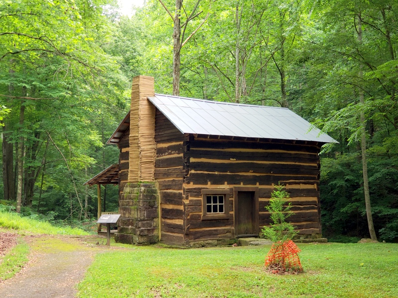
Today, I went over to the historical area of our campground where the US Corp of Engineers has built a little museum and history center. As it turns out, prior to damming the Little Kanawha River (a tributary to the Ohio River), forming Burnsville Lake in 1976, they discovered a number of historical buildings. They decided to save these relics of the past by disassembling them and moving them to this spot. This is also where Moses Carpenter built his family house and farm in the first half of the 1800s.


20180619_150806

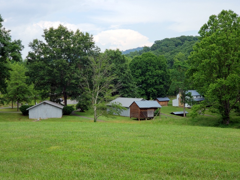
Thus, along with the museum and historical center, you have the original Carpenter house, many of his outbuildings, and two 1800s log cabins.


20180619_143529


20180619_144039

Besides all of the above, there is also the site of the 1863 Battle of Bulltown, where “Mudwall” Jackson, the cousin of Stonewall Jackson, fought a Union fortification that controlled this area. I will write about that battle in a future blog.

 
Todays’ blog is about what I learned of the Bulltown Massacre, where a friendly tribe of Delaware Indians were allegedly murdered out of revenge for another massacre the Indians were accused of committing near what is now Centralia, West Virginia, near the Braxton-Webster county line to the north.

 
As you will learn, according to local lore, which has been handed down from generation to generation, in 1772, the Indian chief, Captain Bull, with his family and about 20 or so other friendly Delaware Indians were supposedly massacred by frontiersmen. The lore states that Jeremiah Carpenter, whose family members were killed by Shawnee Indians, led the alleged massacre. It is told that the Shawnee created a false trail which led Jeremiah Carpenter to Captain Bull and his tribe. He mistakenly thought these were the Indians that murdered his family.

 
Before I get into what I discovered about this very interesting story, I wish to note that Jeremiah Carpenter was a remarkable fiddle player who wrote the tune “Shelvin’ Rock”. The tune is about the experience of escaping from Indians to a rock shelter where he hid with his Indian wife. She gave birth to their son. Solomon, under that ledge. You can read more about the Carpenters and their generations of remarkable West Virginian fiddlers by going to: CLICK HERE and you can listen to the tune “Shelvin Rock” by going to: CLICK HERE

 
While I was at the historical center, a US Corp Of Engineers volunteer gave me a personalized tour of the historical buildings and the Civil War battlefield. It lasted almost 3 hours. Along the way, we stopped in a clearing in the woods along creek that runs into the Little Kanawha River where the Bulltown Massacre allegedly occurred and he presented me with a detailed description of its history as if it was fact.


As I later discovered, the story is actually based on lore that was been passed down and modified through generations. The story he shared with me was so remarkable that I decided to research it further when I returned to LeuC.


What I learned contradicts the story of the massacre that I was told. In fact, it supports the position that the Bulltown Massacre never occurred. Instead, it appears that Captain Bull and his followers moved on and left the area safely. Furthermore, it appears that the massacre of settlers which occurred up near Centralia, did occur but it happened years later, closer to the 1790s instead of in the 1770s. In fact, Jeremiah’s brother, Benjamin, who was killed in that raid, actually fought in the Revolutionary War.

I found a report entitled: “History of Braxton County and central West Virginia”, dated 1919 which states:

“Of this interesting pioneer family, more than a passing notice should be given. As early as 1790 or perhaps a year or two earlier, Jeremiah and Benjamin Carpenter settled on the Elk river near the mouth of the Holly. Their mother and a brother named Enos lived with them. Jeremiah settled on what is known as the Samuel Skidmore bottom, and Benjamin’s cabin stood in the “bottom just below the mouth of the Holly. Their father’s name was “William and was killed at the Big Bend on Jacksons’ river by the Indians, and his son Jeremiah was taken prisoner and remained with the Indians from his ninth to his eighteenth year. He together with three of his brothers, afterward became soldiers in the Revolutionary army.

Their settlement must have been but a few years prior to 1792 as this is the date of the Indian raid in which his brother Benjamin and his wife were killed; and either at this time or perhaps a raid that was made a few months later, he and his family made their escape to a cliff of rocks, and within their stay there his son, Solomon was born, being the first white child born in the county.”


The following is a modified version of a 1940 article I found on the Internet. It is the most comprehensive history and analysis of Captain Bull and The Bulltown Massacre that I have found. Instead of writing about this bit of interesting history, I have revised the original text a bit and shortened it considerably. It is posted below. If you are interested in reading the original text, you can go to: CLICK HERE


Please note that West Virginia did not become a State until it ceded from Virginia during the Civil War. It was granted statehood by the Union in 1863, the same year that Nevada became a State. Until then, and during the time of Captain Bull, it was just part of western Virginia.


Also, note that because this text is so long, today’s portion of it is just on the background of Captain Bull and that period of time which led up to the alleged massacre. The rest of the text concerning the alleged massacre will continue tomorrow.

BULLTOWN

========
By

Don Norman

Captain Bull, the Delaware chief whose name is perpetuated in Bulltown on the Little Kanawha river in Braxton County, WV, came to the hills of northwest Virginia as an exile from his homeland on the upper Susquehanna in New York State. In 1764, when he led his twenty relatives to the site of the present town, he was fleeing the wrath of the English Indian Commissioner, Sir William Johnson, who had become incensed against the Delaware after discovering Captain Bull’s role in the Pontiac conspiracy (see below).
Johnson had organized a band of English settlers and friendly Indians and in March of 1764 this group captured Bull and a number of his adherents. Bull was led in irons to New York City. After a short imprisonment, however, he had been released on his promise to leave the territory.
Captain Bull was the son of Teddyuscung, the last chieftain of the Delaware tribe. Teddyuscung, born at Trenton, New Jersey about 1705, had been chosen Chief of the Delawares at about 50 years of age. He was once baptized by the Moravians as brother Gideon and was an Indian advocate of peace. However, after General Braddock was defeated during the French and Indian Wars, Teddyuscung became an enemy of white settlers. He was burned to death on the night of April 16, 1764, when enemy Indians, either Seneca or Mohawk, set fire to his lodge in the Indian village at Wyoming, New York while he lay drunk.
After his father’s death, Captain Bull led a band of dissatisfied Delaware braves into the hostile camp of Chief Pontiac. He then led a series of raids on settlers which finally led to his arrest. His arrest and exile prevented him from becoming the Great Chief of the Delaware.
PONTIAC’S CONSPIRACY
At the time of the Conspiracy, small English garrisons occupied the forts along the shores of the Great Lakes and in the territory drained by the Ohio River and its tributaries, and the French held posts on the Wabash and Mississippi Rivers and had a considerable settlement at New Orleans. Discontent moldered amongst the Indians, since most of the Indians preferred the more casual French to the English, believing that the English would drive them from their hunting grounds and treat them with neglect and injustice.
French traders from St. Louis and Montreal worked on their fears and fomented disaffection and the result was an uprising under the leadership of Pontiac, Chief of the Ottawa warriors, who was determined to restore the supremacy that the French and Indians had enjoyed before the fall of Quebec and DeVaudreuvil’s capitulation at Montreal.
In 1763, Sir William Johnson estimated that Pontiac’s forces were not more than ten thousand warriors from the Delaware, Iroquois, Shawnee, Guyandotte, Miami, Kickapoo, Ottawa and Ojibwa tribes. Captain Bull led about 600 Delawares who were included in Pontiac’s plan and Bull was as deeply involved in the scheme as any other participant.
Eagle’s “History of Pennsylvania”, “The Pennsylvania Gazette”, “Frontier Forts of Pennsylvania” and Miner’s “History of Wyoming Valley” give details of two marauding raids of Captain Bull’s followers. On October 8, 1763, the Delawares burned farms and houses and killed at least 23 people, men, women and children, and wounded many more. On another raid in the Wyoming Valley on October 15, 1763, the Delawares killed at least twenty people and destroyed many houses.
Early in 1764, Andrew Montour led a force of about 200 Iroquois and a few whites against a Delaware raiding party on the upper Susquehanna in Steuben County New York. Twenty-nine prisoners were captured, including Captain Bull. A 1764 letter from Commissioner William Johnson to Thomas Gage relates the story of Bull’s capture and imprisonment and comments on his character and activities.

“Dear Sir:
I have the pleasure to acquaint you that the prisoners arrived here on the 15 of March & were yesterday sent down under a Guard of a Capt. and 50 Provincials to Albany….The number of prisoners I have sent to Coll Elliot are 14 men, with Capt. Bull, a villain of the first rank, the manner of their being taken disagrees with what I first heard, except that one of them was wounded, as he made a good deal of resistance when they Tyed him up, but it is with particular satisfaction I inform you that they are all of Kanestio and have many prisoners amongst them which Bull offered for his ransom, he told the party that took him that he had with his own hands killed 26 English since Spring & it appears that their design was to come here, make offers of peace, beg for a little ammunition & on their return destroy Cherry-Valley or some other of our settlements, they insulted the Indians of 2 or 3 Small Friendly villages & shot down their cattle, & took away their provisions by force. Capt Bull did not attempt to deny his behavior, and on my asking him on what account he became sonveterate an Enemy, he told me, he did not know, that he was advised to do it, & his party followed his example; he is a fellow of great address, but feigns ignorance &is full of prevarication, he is very likely and remarkably active as are several of the others with him, which makes me dread their escaping, altho’ I told him if he attempted to escape, those in our hands would be put to death immediately.”

 
Captain Bull was released from the New York prison on condition that he leave the State and never return. This he did, with more than forty Delewares, men, women and children appearing at Frederick Ice’s settlement on the Cheat River in VA in the summer of 1764. They remained until the late Fall, when they moved up the Monongahela River and camped at the site of present day Fairmont, WV.
In the Spring of 1765, the Delawares moved to the site of present day Weston, WV and camped for a while before moving to the Bulltown site.  No one knows how or why Bull chose his next home along the Little Kanawha in what was to become Braxton county WV. Nevertheless, the location was ideal. Game was plentiful, rich ground grew good crops and there was a salt spring.
Although the saline waters of the spring at the Indian village were not very salty and about 800 gallons of water had to be evaporated by the primitive method of gathering the brine in wooden trough and heating it by dropping in hot stones to yield a bushel of salt, they were able to make enough for their own needs, with a small quantity for trade. Salt was a precious commodity in those time and whites came from Randolph County to trade for salt as early as 1770.
The Indians hunted, fished, made salt and visited pioneer settlements in the country farther north, and according to Withers’ “Chronicles of Border Warfare”, the settlement had grown to more than a hundred persons by 1772. Withers’ number of inhabitants is at considerable variance with a head count detailed in a letter from Captain James Booth to Zackwell Morgan. Booth stated that the town consisted of Captain Bull, sixteen warriors, fifteen squaws, eight or more children and twenty cabins. Since Booth was a contemporary of Captain Bull and Withers was writing more than fifty years after the events, Booth’s figures seem more likely to be accurate.
Captain Bull, after coming to western Virginia, was a different character; during the years that he and his people inhabited the Little Kanawha valley, he was peaceful toward the whites with whom he came in contact, often hunting with them. His tepee was always open to the hunter and the pioneer and he was their friend. However, Bull’s attitude was not typical of the times.”

 
This story will be continued in tomorrow’s blog.